Top of the Rockies National Scenic Byway
Colorado Scenic and Historic Byway
Top of the Rockies | |
|---|---|
| Route information | |
| Maintained by CDOT | |
| Length | 115 mi[1] (185 km) |
| Existed | 1993–present |
| Major junctions | |
| South end |  SH 82 in Aspen or SH 82 in Aspen or SH 82 / US 24 2 miles (3 km) north of Granite SH 82 / US 24 2 miles (3 km) north of Granite |
| North end |  I-70 exit 171 2 miles (3 km) north of Minturn or I-70 exit 195 at Copper Mountain I-70 exit 171 2 miles (3 km) north of Minturn or I-70 exit 195 at Copper Mountain |
| Location | |
| Country | United States |
| State | Colorado |
| Counties | Eagle, Lake, Pitkin, Summit |
| Highway system | |
| |


The Top of the Rockies National Scenic Byway[1][2][3] is a National Scenic Byway and Colorado Scenic and Historic Byway located in the high Rocky Mountains of Eagle, Lake, Pitkin, Summit counties, Colorado, United States. The 115-mile (185 km) byway showcases the two highest peaks of the Rocky Mountains: Mount Elbert at elevation 14,440 feet (4,401.2 m) and Mount Massive at elevation 14,428 feet (4,398 m). The byway connects with the Collegiate Peaks Scenic Byway at the junction of Colorado State Highway 82 and U.S. Highway 24.
The byway has two northern extensions. The northwestern extension extends from the historic mining town of Leadville over Tennessee Pass to Interstate 70 near Minturn. The northeastern extension extends from Leadville over Fremont Pass to I-70 at Copper Mountain. The two extensions can be driven together as a tour from I-70 to Leadville and back to I-70.
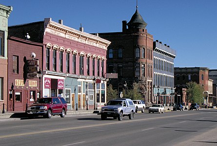
The byway crosses the Continental Divide at Independence Pass at 12,095 feet (3,687 m) elevation, Fremont Pass at 11,318 feet (3,450 m) elevation, and Tennessee Pass at 10,424 feet (3,177 m) elevation. Independence Pass is closed from October to May. The gold mining ghost town of Independence is a historic townsite 2.2 miles (4 km) west of Independence Pass. The Leadville Historic District is a National Historic Landmark. History Colorado operates the Healy House Museum and Dexter Cabin in Leadville. The City of Leadville is the highest incorporated city in North America with a downtown elevation of 10,152 feet (3,094 m).
Route description
The byway starts in Aspen, traveling on SH 82 east over Independence Pass and near the Twin Lakes to just north of the town of Granite. The route then continues north on US 24 through Leadville to Interstate 70 (I-70). A spur of the byway continues along the entire length of SH 91 from Leadville to Copper Mountain, through Fremont Pass.[4]
Major intersections
Main route
| County | Location | mi | km | Destinations | Notes |
|---|---|---|---|---|---|
| Pitkin | Aspen | 0.0 | 0.0 |  SH 82 west SH 82 west | |
| Lake | |  US 24 south US 24 south | Byway continues on US 24 north | ||
| Leadville |   SH 91 north SH 91 north | ||||
| Eagle | Minturn |  I-70 / US 6 – Denver, Grand Junction I-70 / US 6 – Denver, Grand Junction | Western terminus of US 24 | ||
| 1.000 mi = 1.609 km; 1.000 km = 0.621 mi | |||||
Fremont Pass route
| County | Location | mi | km | Destinations | Notes |
|---|---|---|---|---|---|
| Lake | | 0.000 | 0.000 | US 24 | |
| Summit | | 22.605 | 36.379 | I-70 | Interchange |
| 1.000 mi = 1.609 km; 1.000 km = 0.621 mi | |||||
Gallery
See also
 History portal
 U.S. Roads portal
 Colorado portal
Notes
References
- ^ a b "Top of the Rockies". Colorado Department of Transportation. 2021. Retrieved March 31, 2022.
- ^ "Top of the Rockies". Colorado Tourism Office. 2022. Retrieved March 31, 2022.
- ^ "Top of the Rockies". America's Scenic Byways. Retrieved March 31, 2022.
- ^ Staff. "Top of the Rockies – CDOT". Colorado Department of Transportation. Retrieved December 30, 2013.
External links
KML file (edit • help)
Template:Attached KML/Top of the Rockies National Scenic Byway
KML is not from Wikidata
Wikimedia Commons has media related to Top of the Rockies National Scenic Byway.
- America's Scenic Byways: Colorado
- Colorado Department of Transportation
- Colorado Scenic & Historic Byways Commission
- Colorado Scenic & Historic Byways
- Colorado Travel Map
- Colorado Scenic & Historic Byways Commission
- Colorado Tourism Office
- History Colorado
- v
- t
- e
Denver (capital)
- Bibliography
- Index
- Outline
- Climate change
- Colleges
- Coloradans
- Elections
- Federal lands
- Geography
- Government
- Historic places
- History
- Images
- Indian reservations
- Law
- Lists
- Military
- Mountains
- Municipalities
- Museums
- National Forests
- National Parks
- Paleontology
- Prehistoric sites
- Prehistory
- Protected areas
- Railroads
- Rivers
- Slavery
- Statistical areas
- Symbols
- Timeline
- Tourist attractions
- Towns
- Trails
- Transportation
- Wildernesses
- Alamosa
- Arvada
- Aspen
- Aurora
- Black Hawk
- Boulder
- Brighton
- Broomfield
- Brush
- Burlington
- Cañon City
- Castle Pines
- Centennial
- Central City
- Cherry Hills Village
- Colorado Springs
- Commerce City
- Cortez
- Craig
- Cripple Creek
- Dacono
- Delta
- Denver
- Durango
- Edgewater
- Englewood
- Evans
- Federal Heights
- Florence
- Fort Collins
- Fort Lupton
- Fort Morgan
- Fountain
- Fruita
- Glendale
- Glenwood Springs
- Golden
- Grand Junction
- Greeley
- Greenwood Village
- Gunnison
- Holyoke
- Idaho Springs
- La Junta
- Lafayette
- Lakewood
- Lamar
- Las Animas
- Leadville
- Littleton
- Lone Tree
- Longmont
- Louisville
- Loveland
- Manitou Springs
- Monte Vista
- Montrose
- Northglenn
- Ouray
- Pueblo
- Rifle
- Rocky Ford
- Salida
- Sheridan
- Steamboat Springs
- Sterling
- Thornton
- Trinidad
- Victor
- Walsenburg
- Westminster
- Wheat Ridge
- Woodland Park
- Wray
- Yuma
- Adams
- Alamosa
- Arapahoe
- Archuleta
- Baca
- Bent
- Boulder
- Broomfield
- Chaffee
- Cheyenne
- Clear Creek
- Conejos
- Costilla
- Crowley
- Custer
- Delta
- Denver
- Dolores
- Douglas
- Eagle
- El Paso
- Elbert
- Fremont
- Garfield
- Gilpin
- Grand
- Gunnison
- Hinsdale
- Huerfano
- Jackson
- Jefferson
- Kiowa
- Kit Carson
- La Plata
- Lake
- Larimer
- Las Animas
- Lincoln
- Logan
- Mesa
- Mineral
- Moffat
- Montezuma
- Montrose
- Morgan
- Otero
- Ouray
- Park
- Phillips
- Pitkin
- Prowers
- Pueblo
- Rio Blanco
- Rio Grande
- Routt
- Saguache
- San Juan
- San Miguel
- Sedgwick
- Summit
- Teller
- Washington
- Weld
- Yuma
- Central Colorado
- Eastern Plains
- Colorado Mineral Belt
- Colorado Piedmont
- Colorado Plateau
- Colorado Western Slope
- Denver Metropolitan Area
- Four Corners Region
- Front Range Urban Corridor
- High Plains
- North Central Colorado Urban Area
- Northwestern Colorado
- San Luis Valley
- South-Central Colorado
- South Central Colorado Urban Area
- Southern Rocky Mountains
- Southwest Colorado
 Colorado portal
39°14′54″N 106°17′30″W / 39.2483°N 106.2917°W / 39.2483; -106.2917 (Leadville, Colorado, USA)


