List of protected areas of Colorado
List of protected areas in the U.S. State of Colorado

This is a list of protected areas in the U.S. State of Colorado.
Federal lands
The United States federal government owns 36.23% of Colorado's total land area.
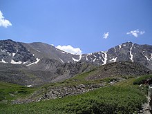
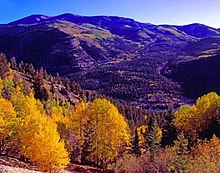
National Park System
The National Park System includes 23 areas in Colorado. The National Park Service manages 18 of these 23 areas plus five National Wildernesses.
National Parks
The four National Parks within Colorado are:
- Black Canyon of the Gunnison National Park near Montrose
- Great Sand Dunes National Park and Preserve near Mosca
- Mesa Verde National Park and UNESCO World Heritage Site near Cortez
- Rocky Mountain National Park near Estes Park and Grand Lake
-

-

-
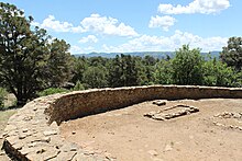
 The Cliff Palace in Mesa Verde National Park.
 -


National Monuments

The nine National Monuments in Colorado are:
- Browns Canyon National Monument[a] near Nathrop (February 19, 2015, Obama)
- Camp Hale-Continental Divide National Monument between Red Cliff and Leadville in the Eagle River valley (October 12, 2022, Biden)
- Canyons of the Ancients National Monument[b] near Dolores (June 9, 2000, Clinton)
- Chimney Rock National Monument[c] near Pagosa Springs (September 21, 2012, Obama)
- Colorado National Monument near Grand Junction and Fruita (May 24, 1911, Taft)
- Dinosaur National Monument[d] near Dinosaur (80 acres October 4, 1915, Wilson, additional 200,000 acres July 14, 1938, F. Roosevelt)
- Florissant Fossil Beds National Monument near Florissant (August 20, 1969, Nixon)
- Hovenweep National Monument[e] near Cortez (March 2, 1923, Harding)
- Yucca House National Monument[f] near Cortez (December 19, 1919, Wilson)
Two former National Monuments were elevated to National Park:
- Black Canyon of the Gunnison National Monument (March 2, 1933, Hoover, to October 21, 1999)
- Great Sand Dunes National Monument (March 17, 1932, Hoover, to September 24, 2004)
Two former National Monuments were abolished due to their remoteness:
- Holy Cross National Monument[c] near Minturn (May 11, 1929, Hoover, abolished August 3, 1950)
- Wheeler National Monument[c] near Creede (December 7, 1908, T. Roosevelt, abolished August 3, 1950)
National Historic Sites

The three National Historic Sites within Colorado are:
- Amache National Historic Site near Granada
- Bent's Old Fort National Historic Site near La Junta
- Sand Creek Massacre National Historic Site near Chivington
National Recreation Areas

The two National Recreation Areas within Colorado are::
National Historic Trails

The four National Historic Trails that pass through Colorado are:
- California National Historic Trail[g] through Sedgwick County
- Old Spanish National Historic Trail[h] through southwestern Colorado
- Pony Express National Historic Trail[i] through Sedgwick County
- Santa Fe National Historic Trail[j] through southeastern Colorado
National Scenic Trail

The National Scenic Trail that passes through Colorado is:
National Forests


The United States Forest Service manages the 11 National Forests within Colorado.
- Arapaho National Forest
- Grand Mesa National Forest
- Gunnison National Forest
- Pike National Forest
- Rio Grande National Forest
- Roosevelt National Forest
- Routt National Forest
- San Isabel National Forest
- San Juan National Forest
- Uncompahgre National Forest
- White River National Forest
National Grasslands

The United States Forest Service manages the two National Grasslands within Colorado.
- Comanche National Grassland – southeastern Colorado
- Pawnee National Grassland – northeastern Colorado
National Wildernesses


There are 44 National Wildernesses within Colorado. The United States Forest Service manages 34, the National Park Service manages four, the Bureau of Land Management manages three, the United States Forest Service and the Bureau of Land Management jointly manage two, and the United States Forest Service and the National Park Service jointly manage one National Wilderness.
- Black Canyon of the Gunnison Wilderness[l]
- Black Ridge Canyons Wilderness[b]
- Buffalo Peaks Wilderness[c]
- Byers Peak Wilderness[c]
- Cache La Poudre Wilderness[c]
- Collegiate Peaks Wilderness[c]
- Comanche Peak Wilderness[c]
- Dominguez Canyon Wilderness[b]
- Eagles Nest Wilderness[c]
- Flat Tops Wilderness[c]
- Fossil Ridge Wilderness[c]
- Great Sand Dunes Wilderness[l]
- Greenhorn Mountain Wilderness[c]
- Gunnison Gorge Wilderness[c]
- Hermosa Creek Wilderness[c]
- Holy Cross Wilderness[c]
- Hunter-Fryingpan Wilderness[c]
- Indian Peaks Wilderness[m]
- James Peak Wilderness[c]
- La Garita Wilderness[c]
- Lizard Head Wilderness[c]
- Lost Creek Wilderness[c]
- Maroon Bells-Snowmass Wilderness[c]
- Mesa Verde Wilderness[l]
- Mount Evans Wilderness[c]
- Mount Massive Wilderness[c]
- Mount Sneffels Wilderness[c]
- Mount Zirkel Wilderness[c]
- Neota Wilderness[c]
- Never Summer Wilderness[c]
- Platte River Wilderness[c]
- Powderhorn Wilderness[a]
- Ptarmigan Peak Wilderness[c]
- Raggeds Wilderness[c]
- Rawah Wilderness[c]
- Rocky Mountain National Park Wilderness[l]
- Sangre de Cristo Wilderness[c]
- Sarvis Creek Wilderness[c]
- South San Juan Wilderness[c]
- Spanish Peaks Wilderness[c]
- Uncompahgre Wilderness[a]
- Vasquez Peak Wilderness[c]
- Weminuche Wilderness[c]
- West Elk Wilderness[c]
National Conservation Areas

The Bureau of Land Management manages the three National Conservation Areas within Colorado.
- Dominguez–Escalante National Conservation Area
- Gunnison Gorge National Conservation Area
- McInnis Canyons National Conservation Area
National Wildlife Refuges

The United States Fish and Wildlife Service manages the eight National Wildlife Refuges within Colorado.
- Alamosa National Wildlife Refuge
- Arapaho National Wildlife Refuge
- Baca National Wildlife Refuge
- Browns Park National Wildlife Refuge
- Monte Vista National Wildlife Refuge
- Rocky Flats National Wildlife Refuge
- Rocky Mountain Arsenal National Wildlife Refuge
- Two Ponds National Wildlife Refuge
Federally designated areas
The following areas are designated by the National Park Service, but reside on a variety of federal, state, county, city, town, and private lands.
National Heritage Areas

The three National Heritage Areas in Colorado are:
- Cache La Poudre River Corridor National Heritage Area
- Sangre de Cristo National Heritage Area
- South Park National Heritage Area
National Historic Landmarks


The 26 National Historic Landmarks in Colorado are:
- Bent's Old Fort[l]
- Burlingon Carousel
- Central City/Black Hawk Historic District
- Colorado Chautauqua
- Colorado Fuel and Iron Company Administrative Complex
- Cripple Creek Historic District
- Cumbres and Toltec Scenic Railroad
- Denver Civic Center
- Durango-Silverton Narrow-Gauge Railroad
- Georgetown-Silver Plume Historic District
- Granada War Relocation Center
- Leadville Historic District
- Lindenmeier site
- Lowry Ruin
- Ludlow Tent Colony Site
- Mesa Verde Administrative District[l]
- Pikes Peak[c]
- Pike's Stockade
- Raton Pass
- Red Rocks Park
- Rocky Mountain National Park Administration Building[l]
- Shenandoah-Dives (Mayflower) Mill
- Silverton Historic District
- Telluride Historic District
- Trujillo Homesteads
- United States Air Force Academy, Cadet Area[n]
National Natural Landmarks

The 16 National Natural Landmarks in Colorado are:
- Big Spring Creek
- Garden of the Gods
- Garden Park Fossil Area
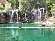
- Hanging Lake
- Indian Springs Trace Fossil Site
- Lost Creek Scenic Area
- Morrison-Golden Fossil Areas
- Raton Mesa
- Roxborough State Park[o]
- Russell Lakes[o]
- Sand Creek
- Slumgullion Earthflow
- Spanish Peaks
- Sulphur Cave and Spring
- Summit Lake
- West Bijou Site
National Recreation Trails


The 28 federally designated National Recreation Trails in Colorado are:
- Apex National Recreation Trail[p] near Golden
- Barr National Recreation Trail[c] between Manitou Springs and Pikes Peak
- Bear Creek National Recreation Trail[c] near Ouray
- Big Dry Creek National Recreation Trail[q] through Westminster
- Calico National Recreation Trail[c] near Dolores
- Crag Crest National Recreation Trail[c] near Cedaredge
- Devils Head National Recreation Trail[c] near Sedalia
- Fish Creek Falls National Recreation Trail[c] near Steamboat Springs
- Grays Peak National Recreation Trail[c] near Silver Plume
- Greyrock Mountain National Recreation Trail[c] near Laporte
- High Line Canal National Recreation Trail[r] through metropolitan Denver
- Highline Loop National Recreation Trail[c] near Dolores
- Lake Fork National Recreation Trail[c] near South Fork
- Mineral Belt National Recreation Trail[s] near Leadville
- Mount Evans National Recreation Trail[c] near Idaho Springs
- Mount McConnel National Recreation Trail[c] near Laporte
- Petroglyph Point National Recreation Trail[l] in Mesa Verde National Park
- Platte River Greenway National Recreation Trail[r] through metropolitan Denver
- Poudre River National Recreation Trail[t] between Greeley and Windsor
- Rocky Mountain Arsenal National Recreation Trails[u] near Denver
- Round Mountain National Recreation Trail[c] near Loveland
- Swamp Park National Recreation Trail[c] near Steamboat Springs
- Two Elk National Recreation Trail[c] near Vail
- Two Ponds National Recreation Trail[u] in Arvada
- Vail Pass National Recreation Trail[c] between Copper Mountain and Vail
- West Lost Trail Creek National Recreation Trail[c] near Creede
- Wheeler Ten Mile National Recreation Trail[c] between Frisco and Copper Mountain
- White House Ranch National Recreation Trail[v] in Colorado Springs
National Register of Historic Places
There are more than 1,500 Colorado sites on the National Register of Historic Places.
Wild and Scenic River

The Wild and Scenic River in Colorado is:
Areas of Critical Environmental Concern

The Bureau of Land Management has designated 88 Areas of Critical Environmental Concern in western Colorado.
State lands
Colorado State Parks


Colorado Parks and Wildlife manages the 43 Colorado State Parks.
- Arkansas Headwaters Recreation Area
- Barr Lake State Park
- Boyd Lake State Park
- Castlewood Canyon State Park
- Chatfield State Park
- Cherry Creek State Park
- Cheyenne Mountain State Park
- Crawford State Park (Colorado)
- Eldorado Canyon State Park
- Eleven Mile State Park
- Elkhead State Park
- Fishers Peak State Park
- Golden Gate Canyon State Park
- Harvey Gap State Park
- Highline Lake State Park
- Jackson Lake State Park (Colorado)
- James M. Robb – Colorado River State Park
- John Martin Reservoir State Park
- Lake Pueblo State Park
- Lathrop State Park
- Lone Mesa State Park
- Lory State Park
- Mancos State Park
- Mueller State Park
- Navajo State Park
- North Sterling State Park
- Paonia State Park
- Pearl Lake State Park
- Ridgway State Park
- Rifle Falls State Park
- Rifle Gap State Park
- Roxborough State Park
- Spinney Mountain State Park
- St. Vrain State Park
- Stagecoach State Park
- State Forest State Park
- Staunton State Park
- Steamboat Lake State Park
- Sweitzer Lake State Park
- Sweetwater Lake State Park
- Sylvan Lake State Park
- Trinidad Lake State Park
- Vega State Park
- Yampa River State Park
Colorado Wildlife Areas

Colorado Parks and Wildlife manages the 307 Colorado State Wildlife Areas.
State designated areas
Colorado Natural Areas


The Colorado Department of Natural Resources has designated 95 Colorado Natural Areas.[1]
- Aiken Canyon Natural Area
- Antero-Salt Creek Natural Area
- Arikaree River Natural Area
- Badger Wash Natural Area
- Blacks Gulch Natural Area
- Blue Mountain Natural Area
- Bonny Prairie Natural Area
- Boulder Mountain Park Natural Area in Boulder Mountain Park
- Brush Creek Fen Natural Area
- California Park Natural Area
- Castlewood Canyon Natural Area in Castlewood Canyon State Park
- Chalk Bluffs Natural Area
- Colorado Tallgrass Prairie Natural Area
- Comanche Grassland Lesser Prairie Chicken Natural Area in Comanche National Grassland
- Copeland Willow Carr Natural Area
- Corral Bluffs Natural Area
- Cross Mountain Canyon Natural Area
- Dakota Hogback Natural Area commonly known as Dinosaur Ridge in Matthews/Winters Park
- Deer Gulch Natural Area
- Dome Rock Natural Area in Dome Rock State Wildlife Area
- Droney Gulch Natural Area
- Duck Creek Natural Area
- Dudley Bluffs Natural Area
- East Lost Park Natural Area in Pike National Forest
- East Sand Dunes Natural Area in State Forest State Park
- Elephant Rocks Natural Area
- Escalante Canyon Natural Area
- Fairview Natural Area
- Fourmile Creek Natural Area
- Fruita Paleontological Locality
- Garden Park Fossil Locality
- Gateway Palisade Natural Area
- Geneva Basin Iron Fens Natural Area
- Gothic Research Natural Area in Gunnison National Forest
- Gunnison Gravels Research Natural Area
- Haviland Lake Natural Area in Haviland Lake State Wildlife Area
- High Creek Fen Natural Area
- High Mesa Grassland Natural Area
- Hoosier Ridge Research Natural Area on the Continental Divide in Pike National Forest and White River National Forest
- Hurricane Canyon Natural Area in Pike National Forest
- Indian Spring Natural Area
- Indian Springs Trace Fossil Locality
- Irish Canyon Natural Area
- Jimmy Creek Natural Area
- Ken-Caryl Ranch Natural Area
- Kremmling Cretaceous Ammonite Locality
- Limestone Ridge Natural Area
- Logan Wash Mine Natural Area
- Lookout Mountain Natural Area
- Lower Greasewood Creek Natural Area
- McElmo Natural Area
- Mexican Cut Natural Area
- Mini-Wheeler Natural Area
- Miramonte Reservoir Natural Area in Dan Noble State Wildlife Area
- Mishak Lakes Natural Area
- Mount Callahan Natural Area
- Mount Callahan Saddle Natural Area
- Mount Emmons Iron Fen Natural Area in Gunnison National Forest
- Mount Goliath Natural Area in Arapaho National Forest
- Narraguinnep Natural Area in San Juan National Forest
- Needle Rock Natural Area
- North Park Phacelia Natural Area
- Orient Mine Natural Area
- Owl Canyon Pinyon Grove Natural Area
- Pagosa Skyrocket Natural Area
- Paradise Park Natural Area in Rocky Mountain National Park
- Park Creek Hogback Natural Area
- Pyramid Rock Natural Area
- Rabbit Valley Natural Area
- Rajadero Canyon Natural Area
- Raven Ridge Natural Area
- Redcloud Peak Natural Area
- Rough Canyon Natural Area
- Roxborough Natural Area in and near Roxborough State Park
- Ryan Gulch Natural Area
- Saddle Mountain Natural Area in Pike National Forest
- San Miguel River at Tabeguache Creek Natural Area
- Sand Creek Natural Area
- Shell Duck Creek Natural Area
- Shell Rock Natural Area
- Slumgullion Earthflow Natural Area in San Juan National Forest
- South Beaver Creek Natural Area
- South Boulder Creek Natural Area
- South Cathedral Bluffs Natural Area
- Specimen Mountain Research Natural Area in Rocky Mountain National Park
- Staunton Natural Area in Staunton State Park
- Tamarack Ranch Natural Area in Tamarack Ranch State Wildlife Area
- Treasurevault Mountain Natural Area
- Trinidad K-T Boundary Natural Area in Trinidad Lake State Park
- Two Buttes Natural Area
- Unaweep Seep Research Natural Area
- Wacker Ranch Natural Area
- West Creek Natural Area in Rocky Mountain National Park
- Wheeler Geologic Natural Area in the La Garita Wilderness of Rio Grande National Forest
- White Rocks Natural Area
- Yanks Gulch/Upper Greasewood Creek Natural Area
- Zapata Falls Natural Area
Regional trails

The following transcontinental hiking trail was established by the American Discovery Trail Society.
The following hiking trail across the Southern Rocky Mountains is maintained by the Colorado Trail Foundation.
The following three single-track mountain bike trails are maintained by the Colorado Plateau Mountain Bike Trail Association and the Bureau of Land Management.
- Kokopelli Trail
- Paradox Trail
- Tabeguache Trail
Bicycle routes

The following four bicycle touring routes through Colorado are regularly scouted by the Adventure Cycling Association.
- Great Divide Mountain Bike Route
- Great Parks Bicycle Route
- TransAmerica Trail Bicycle Route
- Western Express Bicycle Route
See also
 Environment portal
 Geography portal
 History portal
 United States portal
 Colorado portal


- Protected areas of the United States
- List of national conservation lands in Colorado
- Bibliography of Colorado
- Geography of Colorado
- History of Colorado
- Index of Colorado-related articles
- List of Colorado-related lists
- Outline of Colorado
Notes
- ^ a b c Jointly managed by the United States Department of the Interior, Bureau of Land Management and the United States Department of Agriculture, United States Forest Service.
- ^ a b c Managed by the United States Department of the Interior, Bureau of Land Management.
- ^ a b c d e f g h i j k l m n o p q r s t u v w x y z aa ab ac ad ae af ag ah ai aj ak al am an ao ap aq ar as at au av aw ax ay az ba bb bc bd be bf Managed by the United States Department of Agriculture, United States Forest Service.
- ^ Dinosaur National Monument extends into the State of Utah.
- ^ Hovenweep National Monument extends into the State of Utah.
- ^ Yucca House National Monument remains undeveloped.
- ^ The California National Historic Trail traverses ten U.S. states: Missouri, Kansas, Nebraska, Colorado, Wyoming, Idaho, Utah, Nevada, Oregon, and California.
- ^ The Old Spanish National Historic Trail traverses six U.S. states: New Mexico, Colorado, Utah, Arizona, Nevada, and California.
- ^ The Pony Express National Historic Trail traverses eight U.S. states: Missouri, Kansas, Nebraska, Colorado, Wyoming, Utah, Nevada, and California.
- ^ The Santa Fe National Historic Trail traverses five U.S. states: Missouri, Kansas, Colorado, Oklahoma, and New Mexico.
- ^ The Continental Divide National Scenic Trail traverses five U.S. states: Montana, Idaho, Wyoming, Colorado, and New Mexico.
- ^ a b c d e f g h Managed by the United States Department of the Interior, National Park Service.
- ^ Jointly managed by the United States Department of the Interior, National Park Service and the United States Department of Agriculture, National Forest Service.
- ^ Managed by the United States Air Force.
- ^ a b Managed by Colorado Parks and Wildlife.
- ^ Managed by the Jefferson County Open Space Program.
- ^ Managed by the City of Westminster, Colorado.
- ^ a b Managed by Colorado State Parks.
- ^ Managed by Lake County, Colorado.
- ^ Managed by the Poudre River Trail Corridor, Inc.
- ^ a b Managed by the United States Department of the Interior, United States Fish and Wildlife Service.
- ^ Managed by the Colorado Springs Parks and Recreation Department.
References
- ^ "Colorado Natural Areas Program, 2018-2020 review, triennal report to Governor Polis" (PDF). Colorado Parks & Wildlife. State of Colorado. n.d. Archived (PDF) from the original on 2022-03-20. Retrieved 2022-07-25.
External links
Colorado at Wikipedia's sister projects
 Media from Commons
 News from Wikinews
 Quotations from Wikiquote
 Travel information from Wikivoyage
- Colorado state government website
- Colorado Department of Natural Resources website
- Colorado Parks & Wildlife website
- Colorado Department of Natural Resources website
- Colorado tourism website
- History Colorado website
- United States federal government website
- United States Department of the Interior website
- Bureau of Land Management website
- National Park Service website
- United States Fish and Wildlife Service website
- United States Department of Agriculture website
- United States Forest Service website
- United States Department of the Interior website
- v
- t
- e
 Protected areas of Colorado
| 43 State Parks |
|
|---|---|
| 1 State Forest | |
| 307 State Wildlife Areas | |
| 96 State Natural Areas |
|
| 26 Scenic and Historic Byways |
|
| 28 National Recreation Trails |
|
|---|---|
| 6 Regional Trails |
38°59′50″N 105°32′52″W / 38.9972°N 105.5478°W / 38.9972; -105.5478 (State of Colorado)


