Podział terytorialny Hobart
Podział terytorialny Hobart – obszar Hobart, podzielony jest na 5 obszarów samorządu lokalnego (ang. local government area). Lista zawiera również wykaz przedmieść i osiedli (ang. suburb) wchodzących w skład tych samorządów.
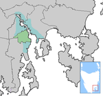
Gmina Brighton

- Bridgewater
- Gagebrook
- Green Point
- Old Beach
- Brighton
Gmina Kingborough

- Blackmans Bay
- Bonnet Hill
- Firthside
- Howden
- Huntingfield
- Kingston
- Kingston Beach
- Taroona
City of Clarence

- Acton
- Bellerive
- Cambridge
- Clarendon Vale
- Clifton Beach
- Flagstaff Gully
- Geilston Bay
- Gregson
- Howrah
- Howrah Heights
- Lauderdale
- Lindisfarne
- Montagu Bay
- Mornington
- Mornington Heights
- Mount Rumney
- Otago Bay
- Risdon
- Risdon Vale
- Rokeby
- Rose Bay
- Rosny
- Rosny Park
- Tranmere
- Warrane
City of Glenorchy

- Abbotsfield
- Austins Ferry
- Berriedale
- Chigwell
- Claremont
- Derwent Park
- Dowsing Point
- Elwick
- Glenlusk
- Glenorchy
- Goodwood
- Granton
- Lutana
- Merton
- Montrose
- Moonah
- Rosetta
- Springfield
- West Moonah
City of Hobart
- Battery Point
- Cascades
- Cornelian Bay
- Dynnyrne
- Fern Tree
- Glebe
- Lenah Valley
- Lower Sandy Bay
- Mt Nelson
- Mt Stuart
- New Town
- North Hobart
- Porters Hill
- South Hobart
- West Hobart
- Sandy Bay
- Tolmans Hill
Gmina Sorell
- Midway Point
Zobacz też
- p
- d
- e
Podział terytorialny stolic w Australii
- p
- d
- e
Obszary samorządowe w stanie Tasmania


