South Northamptonshire
| South Northamptonshire | |||
|---|---|---|---|
| | |||
| Land |  Storbritannia Storbritannia | ||
| Konst. land |  England England | ||
| Region | Øst-Midlands | ||
| Adm. grevskap | Northamptonshire | ||
| Seremonielt grevskap | Northamptonshire | ||
| Status | Distrikt | ||
| Grunnlagt | 1974 | ||
| Opphørt | 1. april 2021 | ||
| Adm. senter | Towcester | ||
| Areal | 634,02 km² | ||
| Befolkning | 85 189 (2011) | ||
| Bef.tetthet | 134,36 innb./km² | ||
| ONS-kode | 34UG | ||
 South Northamptonshire 52°06′N 1°06′V | |||
South Northamptonshire på Commons | |||
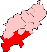
South Northamptonshire er et administrativt distrikt i Northamptonshire i England. Administrasjonssenteret er Towcester.
Distriktet ble opprettet 1. april 1974 ved sammenslåing av Brackley, Brakcley landdistrikt, Towcester landdistrikt og deler av Northampton landdistrikt. Det meste av distriktet er landsbygd; den største byen er Brackley med omkring 13 000 innbyggere (2005). Distriktet dekker et areal på 634,02 km² og hadde 85 189 innbyggere i 2011.[1]
Steder i distriktet
- Abthorpe, Adstone, Ashton, Aston le Walls, Aynho
- Blakesley, Blisworth, Boddington, Brackley, Bradden, Brafield-on-the-Green, Bugbrooke
- Castle Ashby, Chacombe, Charlton, Chipping Warden, Cogenhoe, Cold Higham, Cosgrove, Courteenhall, Croughton, Culworth
- Deanshanger, Denton
- Easton Neston, Edgcote, Evenley, Eydon
- Farthinghoe
- Gayton, Grafton Regis, Grange Park, Greatworth, Greens Norton
- Hackleton, Harpole, Hartwell, Helmdon, Hinton-in-the Hedges
- Kings Sutton, Kislingbury
- Litchborough, Little Houghton
- Maidford, Marston St Lawrence, Middleton Cheney, Milton Malsor, Moreton Pinkney
- Nether Heyford, Newbottle
- Old Stratford, Overthorpe
- Pattishall, Paulerspury, Potterspury
- Quinton
- Radstone, Roade, Rothersthorpe
- Shutlanger, Silverstone, Slapton, Stoke Bruerne, Sulgrave, Syresham
- Thenford, Thorpe Mandeville, Tiffield, Towcester
- Upper Heyford
- Wappenham, Warkworth, Weedon Lois, Weston, Whiston, Whitfield, Whittlebury, Wicken, Woodend
- Yardley Gobion, Yardley Hastings
Referanser
- ^ «Census 2011: Usual resident population». Nomis. Office for National Statistics. Besøkt 5. juni 2018.
Eksterne lenker
- Offisielt nettsted

- (en) South Northamptonshire District – kategori av bilder, video eller lyd på Commons
Distrikter i Øst-Midlands | |||
|---|---|---|---|
 | Amber Valley · Ashfield · Bassetlaw · Blaby · Bolsover · Boston · Broxtowe · Charnwood · Chesterfield · Corby · Daventry · Derby · Derbyshire Dales · East Lindsey · East Northamptonshire · Erewash · Gedling · Harborough · High Peak · Hinckley and Bosworth · Kettering · Leicester · Lincoln · Mansfield · Melton · Newark and Sherwood · Northampton · North East Derbyshire · North Kesteven · North West Leicestershire · Nottingham · Oadby and Wigston · Rushcliffe · Rutland · South Derbyshire · South Holland · South Kesteven · South Northamptonshire · Wellingborough · West Lindsey |  | |
Administrative grevskap med flere distrikter: Derbyshire - Leicestershire - Lincolnshire - Northamptonshire - Nottinghamshire | |||


