King William County
| King William fylke i Virginia | |||
|---|---|---|---|
 | |||
| Grunnlagt | 1702 | ||
| Oppkalt etter | Vilhelm III av England | ||
| Fylkessete | King William | ||
| Areal - Totalt - Land - Vann | 739,83 km² 713,36 km² 26,47 km² | ||
| Befolkning - Tetthet | 15 381 (2006) 20,79 innb./km² | ||
 King William fylke 37°42′24″N 77°05′18″V | |||
King William County på Commons | |||
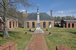
King William County er et fylke i den amerikanske delstaten Virginia.
Eksterne lenker
- (en) Offisielt nettsted

- (en) King William County, Virginia – kategori av bilder, video eller lyd på Commons
| |||
|---|---|---|---|
 | Accomack · Albemarle · Alleghany · Amelia · Amherst · Appomattox · Arlington · Augusta · Bath · Bedford · Bland · Botetourt · Brunswick · Buchanan · Buckingham · Campbell · Caroline · Carroll · Charles City · Charlotte · Chesterfield · Clarke · Craig · Culpeper · Cumberland · Dickenson · Dinwiddie · Essex · Fairfax · Fauquier · Floyd · Fluvanna · Franklin · Frederick · Giles · Gloucester · Goochland · Grayson · Greene · Greensville · Halifax · Hanover · Henrico · Henry · Highland · Isle of Wight · James City · King and Queen · King George · King William · Lancaster · Lee · Loudoun · Louisa · Lunenburg · Madison · Mathews · Mecklenburg · Middlesex · Montgomery · Nelson · New Kent · Northampton · Northumberland · Nottoway · Orange · Page · Patrick · Pittsylvania · Powhatan · Prince Edward · Prince George · Prince William · Pulaski · Rappahannock · Richmond · Roanoke · Rockbridge · Rockingham · Russell · Scott · Shenandoah · Smyth · Southampton · Spotsylvania · Stafford · Surry · Sussex · Tazewell · Warren · Washington · Westmoreland · Wise · Wythe · York |  | |
Denne artikkelen er en spire. Du kan hjelpe Wikipedia ved å utvide den.


