Foresthill
Plaats in de Verenigde Staten  | |||
|---|---|---|---|
  | |||
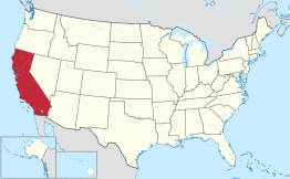 Locatie van Californië in de VS | |||
| Situering | |||
| County | Placer County | ||
| Type plaats | Census-designated place | ||
| Staat | Californië | ||
| Coördinaten | 39° 1′ NB, 120° 50′ WL | ||
| Algemeen | |||
| Oppervlakte | 29,0 km² | ||
| - land | 29 km² | ||
| - water | 0,0 km² | ||
| Inwoners (2000) | 1.791 | ||
| Hoogte | 787 m | ||
| Overig | |||
| ZIP-code(s) | 95631 | ||
| FIPS-code | 24834 | ||
| |||

Foresthill is een plaats (census-designated place) in de Amerikaanse staat Californië, en valt bestuurlijk gezien onder Placer County.
Demografie
Bij de volkstelling in 2000 werd het aantal inwoners vastgesteld op 1791.[1]
Geografie
Volgens het United States Census Bureau beslaat de plaats een oppervlakte van 29,0 km², geheel bestaande uit land. Foresthill ligt op ongeveer 787[2] m boven zeeniveau.
Plaatsen in de nabije omgeving
De onderstaande figuur toont nabijgelegen plaatsen in een straal van 24 km rond Foresthill.
 Foresthill
 Alta Sierra (22 km)
  Colfax (13 km)
  Georgetown (12 km)
  Lake of the Pines (20 km)
  Meadow Vista (17 km)
  North Auburn (23 km)
 Zie ook
- Foresthill Bridge
Externe link
- (en) Statistieken, kaarten en andere informatie over Foresthill op city-data.com
| Bronnen, noten en/of referenties |


