Trory
Village in County Fermanagh, Northern Ireland
Human settlement in Northern Ireland
- List of places
- UK
- Northern Ireland
- Fermanagh

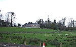
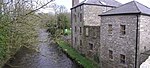
Trory (from Irish Treabhraigh, meaning 'place of tillage') is a townland (of 335 acres), small village and civil parish in County Fermanagh, Northern Ireland, 3 miles (5 km) north of Enniskillen.[1] The townland is situated in the historic barony of Tirkennedy, but the civil parish covers areas of the barony of Tirkennedy, as well as the barony of Lurg.[2][3] In the 2001 Census it had (with Ballycassidy and Laragh) a population of 315 people.[4] It lies within the Fermanagh and Omagh District Council area.
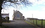
St Michael's Church of Ireland Parish Church in Trory is a listed building.
Transport
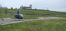
The ferry to Devenish Island leaves from Trory point about 1.5 miles out of Enniskillen.[5]
Civil parish of Trory


The civil parish includes the small village of Ballycassidy.
Townlands
The civil parish includes the following townlands:[3]
B
Ballycassidy, Buninubber
C
Car Island, Cloghbally, Concrick
D
Derryargon, Derrygore, Derryinch, Drumcoo, Drumgarrow, Drummackilowney
F
Ferny Island
G
Gublusk
H
Hay Island
I
Inish Free
K
Kilmacormick
L
Laragh, Long Island
M
Mossfield (also known as Urbal)
O
Oghill
P
Paris Island Big, Paris Island Little
R
Ring, Rockfield, Rossahilly
S
Shanmullagh, Srahenny
T
Thornhill Glebe, Trasna Island, Trory, Tully, Tullyavy, Tullylone
U
Urbal (also known as Mossfield)
W
White Island
See also
- List of townlands in County Fermanagh
- List of towns and villages in Northern Ireland
- List of civil parishes of County Fermanagh
References
- ^ Sanderson, Ernest (1976). Discover Northern Ireland. Belfast: Northern Ireland Tourist Board. p. 141. ISBN 0 9500222 7 6.
- ^ "Trory". Place Names NI. Retrieved 19 April 2015.
- ^ a b "Trory". IreAtlas Townlands Database. Retrieved 19 April 2015.
- ^ NI Neighbourhood Information System
- ^ Enniskillen.com Archived 2008-12-24 at the Wayback Machine
Wikimedia Commons has media related to Trory.
- v
- t
- e
Places in County Fermanagh
and townlands
- Aghadrumsee
- Aghakeeran
- Aghanaglack
- Arney
- Ballinamallard
- Ballycassidy
- Belcoo
- Bellanaleck
- Belleek
- Blaney
- Boho
- Brookeborough
- Carn
- Carr
- Castle Balfour Demesne
- Castle Coole
- Clabby
- Clogherbog
- Cooltrain
- Currin
- Derrygonnelly
- Derrylin
- Derryvore
- Donagh
- Drumbegger
- Drumcreen
- Drumlaghy
- Drummurry
- Drumskinny
- Drumsloe
- Ederney
- Florencecourt
- Garrison
- Glenkeel
- Holywell
- Irvinestown
- Kesh
- Killadeas
- Kilnamadoo
- Killydrum
- Kinawly
- Knockmore
- Knocknahunshin
- Knocks
- Lack
- Laragh
- Letterbreen
- Levally Lower
- Lisbellaw
- Lisnarick
- Lisnaskea
- Macken
- Magheracross
- Magheraveely
- Maguiresbridge
- Monea
- Moylehid
- Newtownbutler
- Pettigo
- Reyfad
- Rosslea
- Salloon
- Skea
- Sidaire
- Springfield
- Tamlaght
- Tattykeeran
- Teemore
- Tempo
- Trory
- Tullyhommon
- Tullygerravra
- WikiProject Northern Ireland
- WikiProject Ireland
- Northern Ireland Portal
- United Kingdom Portal
- Ireland Portal


