Snelrewaard
Hamlet in Utrecht, Netherlands

Coat of arms
52°1′59″N 4°55′1″E / 52.03306°N 4.91694°E / 52.03306; 4.91694
Montfoort
(2021)[1]
3425[1]
Snelrewaard is a hamlet in the Dutch province of Utrecht. It is a part of the municipality of Oudewater, and lies about 2 km east of the city of Oudewater. A small part of the hamlet is in Montfoort.[3]
Snelrewaard was a separate municipality from 1817 to 1989, when it was merged with Oudewater.[4]
It was first mentioned around 1307 as Snoyelrewaert, and means "land near water belonging to Snel (polder)".[5] Snelrewaard has place name signs. In 1840, it was home to 140 people.[3]
Gallery
-
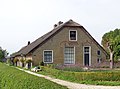 Farm in Snelrewaard
 -
 Farm in Snelrewaard
 -
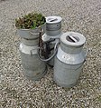 Milk churns


References
- ^ a b c "Kerncijfers wijken en buurten 2021". Central Bureau of Statistics. Retrieved 27 March 2022.
- ^ "Postcodetool for 3425EJ". Actueel Hoogtebestand Nederland (in Dutch). Het Waterschapshuis. Retrieved 28 March 2022.
- ^ a b "Snelrewaard". Plaatsengids (in Dutch). Retrieved 28 March 2022.
- ^ Ad van der Meer and Onno Boonstra, Repertorium van Nederlandse gemeenten, KNAW, 2011.
- ^ "Snelrewaard - (geografische naam)". Etymologiebank (in Dutch). Retrieved 28 March 2022.
Wikimedia Commons has media related to Snelrewaard.
- v
- t
- e
Populated places in the municipality of Oudewater
- Hoenkoop
- Lange Linschoten
- Ruigeweide
- Snelrewaard
 | This Utrecht location article is a stub. You can help Wikipedia by expanding it. |
- v
- t
- e


