Rosdorf, Schleswig-Holstein
Municipality in Schleswig-Holstein, Germany

Coat of arms
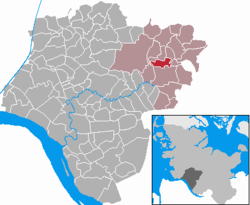
Location of Rosdorf within Steinburg district
53°58′N 9°43′E / 53.967°N 9.717°E / 53.967; 9.717
(2022-12-31)[1]
25548
Rosdorf is a municipality in the district of Steinburg, in Schleswig-Holstein, Germany. It is located around 3 kilometres north of Kellinghusen and east of the Stör River. Rosdorf is situated in the Aukrug Nature Park. The federal highway Bundesstraße 206 from Lübeck to Itzehoe is about 4 kilometres south of Rosdorf.
References
- ^ "Bevölkerung der Gemeinden in Schleswig-Holstein 4. Quartal 2022" (XLS) (in German). Statistisches Amt für Hamburg und Schleswig-Holstein.
- v
- t
- e
Towns and municipalities in Steinburg
- Aasbüttel
- Aebtissinwisch
- Agethorst
- Altenmoor
- Auufer
- Bahrenfleth
- Beidenfleth
- Bekdorf
- Bekmünde
- Besdorf
- Blomesche Wildnis
- Bokelrehm
- Bokhorst
- Borsfleth
- Breitenberg
- Breitenburg
- Brokdorf
- Brokstedt
- Büttel
- Christinenthal
- Dägeling
- Dammfleth
- Drage
- Ecklak
- Elskop
- Engelbrechtsche Wildnis
- Fitzbek
- Glückstadt
- Grevenkop
- Gribbohm
- Hadenfeld
- Heiligenstedten
- Heiligenstedtenerkamp
- Hennstedt
- Herzhorn
- Hingstheide
- Hodorf
- Hohenaspe
- Hohenfelde
- Hohenlockstedt
- Holstenniendorf
- Horst
- Huje
- Itzehoe
- Kaaks
- Kaisborstel
- Kellinghusen
- Kiebitzreihe
- Kleve
- Kollmar
- Kollmoor
- Krempdorf
- Krempe
- Kremperheide
- Krempermoor
- Kronsmoor
- Krummendiek
- Kudensee
- Lägerdorf
- Landrecht
- Landscheide
- Lockstedt
- Lohbarbek
- Looft
- Mehlbek
- Moordiek
- Moorhusen
- Mühlenbarbek
- Münsterdorf
- Neuenbrook
- Neuendorf bei Elmshorn
- Neuendorf-Sachsenbande
- Nienbüttel
- Nortorf
- Nutteln
- Oelixdorf
- Oeschebüttel
- Oldenborstel
- Oldendorf
- Ottenbüttel
- Peissen
- Pöschendorf
- Poyenberg
- Puls
- Quarnstedt
- Rade
- Reher
- Rethwisch
- Rosdorf
- Sankt Margarethen
- Sarlhusen
- Schenefeld
- Schlotfeld
- Siezbüttel
- Silzen
- Sommerland
- Stördorf
- Störkathen
- Süderau
- Vaale
- Vaalermoor
- Wacken
- Warringholz
- Westermoor
- Wewelsfleth
- Wiedenborstel
- Willenscharen
- Wilster
- Winseldorf
- Wittenbergen
- Wrist
- Wulfsmoor

Authority control databases | |
|---|---|
| National |
|
| Geographic |
|
 | This Steinburg location article is a stub. You can help Wikipedia by expanding it. |
- v
- t
- e


