Rangárþing eystra
Municipality in Southern Region, Iceland

Coat of arms
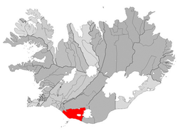
Location of Rangárþing eystra
860, 861
Rangárþing eystra (Icelandic pronunciation: [ˈrauŋkˌaurˌθiŋk ˌeistra] ⓘ) is a municipality located in southern Iceland in the Southern Region, between Eystri Rangá in the west and Jökulsá á Sólheimasandi in the east. The largest settlements are Skógar and Hvolsvöllur.
References
External links
- Official website (in Icelandic)
- v
- t
- e
Municipalities of Iceland
- Garðabær
- Hafnarfjarðarkaupstaður
- Kjósarhreppur
- Kópavogsbær
- Mosfellsbær
- Reykjavíkurborg
- Seltjarnarneskaupstaður
- Grindavíkurbær
- Reykjanesbær
- Suðurnesjabær
- Sveitarfélagið Vogar
- Húnabyggð
- Húnaþing vestra
- Skagabyggð
- Sveitarfélagið Skagafjörður
- Sveitarfélagið Skagaströnd
| Authority control databases |
|
|---|
63°45′00″N 20°14′02″W / 63.750°N 20.234°W / 63.750; -20.234
 | This Iceland location article is a stub. You can help Wikipedia by expanding it. |
- v
- t
- e


