Popotla metro station
Mexico City metro station
19°27′08″N 99°10′29″W / 19.452147°N 99.1747°W / 19.452147; -99.1747 (Cuatro Caminos - Tasqueña)
 12.85%
| Preceding station |  Mexico City Metro Mexico City Metro | Following station | ||
|---|---|---|---|---|
| Cuitláhuac toward Cuatro Caminos | Line 2 | Colegio Militar toward Tasqueña | ||
Route map | |||||||||||||||||||||||||||||||||||||||||||||||||||||||||||||||||||||||||||||||||||||||||||||||||||||||||||||||||||||||||||||||||||||||||||||||||||||||||||||||||||||||||||||||||||||||||||||||||||
|---|---|---|---|---|---|---|---|---|---|---|---|---|---|---|---|---|---|---|---|---|---|---|---|---|---|---|---|---|---|---|---|---|---|---|---|---|---|---|---|---|---|---|---|---|---|---|---|---|---|---|---|---|---|---|---|---|---|---|---|---|---|---|---|---|---|---|---|---|---|---|---|---|---|---|---|---|---|---|---|---|---|---|---|---|---|---|---|---|---|---|---|---|---|---|---|---|---|---|---|---|---|---|---|---|---|---|---|---|---|---|---|---|---|---|---|---|---|---|---|---|---|---|---|---|---|---|---|---|---|---|---|---|---|---|---|---|---|---|---|---|---|---|---|---|---|---|---|---|---|---|---|---|---|---|---|---|---|---|---|---|---|---|---|---|---|---|---|---|---|---|---|---|---|---|---|---|---|---|---|---|---|---|---|---|---|---|---|---|---|---|---|---|---|---|---|
| |||||||||||||||||||||||||||||||||||||||||||||||||||||||||||||||||||||||||||||||||||||||||||||||||||||||||||||||||||||||||||||||||||||||||||||||||||||||||||||||||||||||||||||||||||||||||||||||||||


Location | |
|---|---|
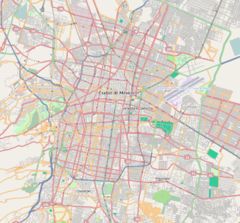   Popotla PopotlaLocation within Mexico City | |
 | |
| Area map |
Popotla is a station on Line 2 of the Mexico City Metro system. It is located in the Colonia Popotla neighborhood of the Miguel Hidalgo borough of Mexico City, northwest of the city center, on the Calzada México-Tacuba.[2][3] In 2019 the station had an average ridership of 10,000 passengers per day, making it the least used station on Line 2.[4]
Name and pictogram
The name of the station comes from the neighborhood it serves: Popotla. The logo depicts an ahuehuete tree, referring to the Árbol de la Noche Triste – the "tree of the sad night" – where Spanish conquistador Hernán Cortés stopped his retreat from Tenochtitlán and cried after being defeated by Cuitláhuac in the Battle of Noche Triste.[2][3] The actual tree survived until the 20th century, when it was destroyed by a fire. There is a commemorative plaque on the site where the tree used to be.
General information
The station was opened on 14 September 1970 as part of the second stretch of Line 2, from Pino Suárez to Tacuba.[5] Metro Popotla serves the neighborhood of the same name.
From 23 April to 24 June 2020, the station was temporarily closed due to the COVID-19 pandemic in Mexico.[6][7]
Ridership
| Annual passenger ridership | |||||
|---|---|---|---|---|---|
| Year | Ridership | Average daily | Rank | % change | Ref. |
| 2023 | 2,804,236 | 7,682 | 136/195 | +12.85% | [1] |
| 2022 | 2,484,958 | 6,808 | 140/195 | +78.75% | [1] |
| 2021 | 1,390,202 | 3,808 | 159/195 | −3.38% | [8] |
| 2020 | 1,438,795 | 3,931 | 172/195 | −60.58% | [9] |
| 2019 | 3,650,212 | 10,000 | 154/195 | −0.80% | [4] |
| 2018 | 3,679,693 | 10,081 | 153/195 | +0.20% | [10] |
| 2017 | 3,672,167 | 10,060 | 150/195 | −2.49% | [11] |
| 2016 | 3,766,005 | 10,289 | 147/195 | −2.36% | [12] |
| 2015 | 3,857,093 | 10,567 | 135/195 | +3.41% | [13] |
| 2014 | 3,729,954 | 10,219 | 136/195 | −5.92% | [14] |
Nearby
- Universidad del Ejército y Fuerza Aérea, university of the Mexican Army and the Air Force
Entrances
- North: Calzada México-Tacuba and Callejón de la Zanja, Popotla
- North: Calzada México-Tacuba and Colegio Militar street, Popotla
See also
References
- ^ a b c d "Afluencia de estación por línea 2023" [Station traffic per line 2023] (in Spanish). Sistema Transporte Colectivo Metro. 2024. Archived from the original on 27 January 2024. Retrieved 24 January 2024.
- ^ a b "Popotla" (in Spanish). Archived from the original on 31 January 2012. Retrieved 16 August 2011.
- ^ a b Archambault, Richard. "Popotla » Mexico City Metro System". Retrieved 16 August 2011.
- ^ a b "Afluencia de estación por línea 2019" [Station traffic per line 2019] (in Spanish). Sistema Transporte Colectivo Metro. 2020. Archived from the original on 8 April 2020. Retrieved 3 May 2020.
- ^ Monroy, Marco. Schwandl, Robert (ed.). "Opening Dates for Mexico City's Subway". Retrieved 15 August 2011.
- ^ "Cierre temporal de estaciones" (PDF) (in Spanish). Metro CDMX. Retrieved 25 April 2020.
- ^ Hernández, Eduardo (13 June 2020). "Coronavirus. Este es el plan para reabrir estaciones del Metro, Metrobús y Tren ligero". El Universal (in Spanish). Retrieved 15 June 2020.
- ^ "Afluencia de estación por línea 2021" [Station traffic per line 2021] (in Spanish). Sistema Transporte Colectivo Metro. 2022. Archived from the original on 7 March 2022. Retrieved 7 March 2022.
- ^ "Afluencia de estación por línea 2020" [Station traffic per line 2020] (in Spanish). Sistema Transporte Colectivo Metro. 2021. Archived from the original on 21 June 2021. Retrieved 21 June 2021.
- ^ "Afluencia de estación por línea 2018" [Station traffic per line 2018] (in Spanish). Sistema Transporte Colectivo Metro. 2019. Archived from the original on 6 June 2019. Retrieved 7 April 2020.
- ^ "Afluencia de estación por línea 2017" [Station traffic per line 2017] (in Spanish). Sistema Transporte Colectivo Metro. 2019. Archived from the original on 3 May 2020. Retrieved 3 May 2020.
- ^ "Afluencia de estación por línea 2016" [Station traffic per line 2016] (in Spanish). Sistema Transporte Colectivo Metro. 2017. Archived from the original on 3 May 2020. Retrieved 3 May 2020.
- ^ "Afluencia de estación por línea 2015" [Station traffic per line 2015] (in Spanish). Sistema Transporte Colectivo Metro. 2016. Archived from the original on 3 May 2020. Retrieved 6 May 2020.
- ^ "Afluencia de estación por línea 2014" [Station traffic per line 2014] (in Spanish). Sistema Transporte Colectivo Metro. 2015. Archived from the original on 3 May 2020. Retrieved 6 May 2020.
External links
Wikimedia Commons has media related to Popotla (station).


| Authority control databases: Geographic |
|
|---|


