National Register of Historic Places listings in Catron County, New Mexico

This is a list of the National Register of Historic Places listings in Catron County, New Mexico.
This is intended to be a complete list of the properties and districts on the National Register of Historic Places in Catron County, New Mexico, United States. Latitude and longitude coordinates are provided for many National Register properties and districts; these locations may be seen together in a map.[1]
There are 11 properties and 3 districts including 1 National Monument listed on the National Register in the county. All of the places within the county on the National Register are also listed on the State Register of Cultural Properties.
This National Park Service list is complete through NPS recent listings posted June 14, 2024.[2]
Map all coordinates using OpenStreetMap
Download coordinates as:
- KML
- GPX (all coordinates)
- GPX (primary coordinates)
- GPX (secondary coordinates)
| Bernalillo – Catron – Chaves – Cibola – Colfax – Curry – De Baca – Doña Ana – Eddy – Grant – Guadalupe – Harding – Hidalgo – Lea – Lincoln – Los Alamos – Luna – McKinley – Mora – Otero – Quay – Rio Arriba – Roosevelt – San Juan – San Miguel – Sandoval – Santa Fe – Sierra – Socorro – Taos – Torrance – Union – Valencia |
Current listings
| [3] | Name on the Register[4] | Image | Date listed[5] | Location | City or town | Description |
|---|---|---|---|---|---|---|
| 1 | Ake Site | Upload image | April 2, 1976 (#76001193) | Address Restricted | Datil | |
| 2 | Bat Cave | Upload image | April 23, 1976 (#76001194) | Address Restricted | Old Horse Springs | |
| 3 | Bearwallow Mountain Lookout Cabins and Shed | Upload image | January 28, 1988 (#87002473) | Bearwallow Lookout Rd. in the Gila National Forest 33°26′57″N 108°40′03″W / 33.449167°N 108.6675°W / 33.449167; -108.6675 (Bearwallow Mountain Lookout Cabins and Shed) | Bearwallow Park | |
| 4 | Black Mountain Lookout Cabin | Upload image | January 28, 1988 (#87002474) | Gila National Forest 33°22′41″N 108°13′36″W / 33.378056°N 108.226667°W / 33.378056; -108.226667 (Black Mountain Lookout Cabin) | Black Mountain | |
| 5 | El Caso Lookout Complex | Upload image | January 28, 1988 (#87002476) | Gila National Forest 34°06′11″N 108°29′39″W / 34.103056°N 108.494167°W / 34.103056; -108.494167 (El Caso Lookout Complex) | El Caso Lake | |
| 6 | Gila Cliff Dwellings National Monument |  | October 15, 1966 (#66000472) | Off New Mexico Highway 15, north of Silver City 33°13′38″N 108°16′20″W / 33.227222°N 108.27222°W / 33.227222; -108.27222 (Gila Cliff Dwellings National Monument) | Silver City | |
| 7 | Mangas Mountain Lookout Complex | Upload image | January 28, 1988 (#87002471) | Mangas Mountain 34°03′07″N 108°18′24″W / 34.051944°N 108.306667°W / 34.051944; -108.306667 (Mangas Mountain Lookout Complex) | Mangas | |
| 8 | Mogollon Baldy Lookout Cabin |  | January 28, 1988 (#87002470) | Gila National Forest 33°16′18″N 108°35′40″W / 33.271660°N 108.594354°W / 33.271660; -108.594354 (Mogollon Baldy Lookout Cabin) | Mogollon Baldy | Log cabin by the fire lookout tower at peak of Mogollon Baldy |
| 9 | Mogollon Historic District | 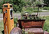 | September 10, 1987 (#87001541) | State Road 78 33°23′45″N 108°47′37″W / 33.395833°N 108.793611°W / 33.395833; -108.793611 (Mogollon Historic District) | Mogollon | |
| 10 | Mogollon Pueblo | Upload image | May 5, 1978 (#78001811) | Address Restricted | Red Hill | Also called Cox Ranch Ruin |
| 11 | Socorro Mines Mining Company Mill, Fannie Hill |  | September 10, 1987 (#87001567) | Fannie Hill and west to Fannie Hill Mill 33°24′11″N 108°47′56″W / 33.403056°N 108.798889°W / 33.403056; -108.798889 (Socorro Mines Mining Company Mill, Fannie Hill) | Mogollon |
See also
- List of National Historic Landmarks in New Mexico
- National Register of Historic Places listings in New Mexico
References
- ^ The latitude and longitude information provided in this table was derived originally from the National Register Information System, which has been found to be fairly accurate for about 99% of listings. Some locations in this table may have been corrected to current GPS standards.
- ^ National Park Service, United States Department of the Interior, "National Register of Historic Places: Weekly List Actions", retrieved June 14, 2024.
- ^ Numbers represent an alphabetical ordering by significant words. Various colorings, defined here, differentiate National Historic Landmarks and historic districts from other NRHP buildings, structures, sites or objects.
- ^ "National Register Information System". National Register of Historic Places. National Park Service. July 9, 2010.
- ^ The eight-digit number below each date is the number assigned to each location in the National Register Information System database, which can be viewed by clicking the number.
- v
- t
- e
- List of U.S. National Historic Landmarks by state:
- Alabama
- Alaska
- Arizona
- Arkansas
- California
- Colorado
- Connecticut
- Delaware
- Florida
- Georgia
- Hawaii
- Idaho
- Illinois
- Indiana
- Iowa
- Kansas
- Kentucky
- Louisiana
- Maine
- Maryland
- Massachusetts
- Michigan
- Minnesota
- Mississippi
- Missouri
- Montana
- Nebraska
- Nevada
- New Hampshire
- New Jersey
- New Mexico
- New York
- North Carolina
- North Dakota
- Ohio
- Oklahoma
- Oregon
- Pennsylvania
- Rhode Island
- South Carolina
- South Dakota
- Tennessee
- Texas
- Utah
- Vermont
- Virginia
- Washington
- West Virginia
- Wisconsin
- Wyoming
 National Register of Historic Places portal
 Category


Municipalities and communities of Catron County, New Mexico, United States | ||
|---|---|---|
County seat: Reserve | ||
| Village |  | |
| CDPs | ||
| Other communities | ||
| Ghost towns | ||
| Indian reservation | ||
| Footnotes | ‡This populated place also has portions in an adjacent county or counties | |
| ||


