Muonio
You can help expand this article with text translated from the corresponding article in Finnish. (January 2022) Click [show] for important translation instructions.
- Machine translation, like DeepL or Google Translate, is a useful starting point for translations, but translators must revise errors as necessary and confirm that the translation is accurate, rather than simply copy-pasting machine-translated text into the English Wikipedia.
- Do not translate text that appears unreliable or low-quality. If possible, verify the text with references provided in the foreign-language article.
- You must provide copyright attribution in the edit summary accompanying your translation by providing an interlanguage link to the source of your translation. A model attribution edit summary is
Content in this edit is translated from the existing Finnish Wikipedia article at [[:fi:Muonio]]; see its history for attribution. - You may also add the template
{{Translated|fi|Muonio}}to the talk page. - For more guidance, see Wikipedia:Translation.
Municipality in Lapland, Finland
Muonio Muonio (Finnish) Muoná (Northern Sami) | |
|---|---|
Municipality | |
| Muonion kunta (Finnish) Muonio kommun (Swedish) | |
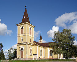 Muonio Church | |
 Coat of arms | |
 Location of Muonio in Finland | |
| Coordinates: 67°57.5′N 023°41′E / 67.9583°N 23.683°E / 67.9583; 23.683 | |
| Country |  Finland Finland |
| Region | Lapland |
| Sub-region | Fell Lapland |
| Charter | 1868 |
| Government | |
| • Municipal manager | Laura Enbuska-Mäki |
| Area (2018-01-01)[1] | |
| • Total | 2,039.97 km2 (787.64 sq mi) |
| • Land | 1,904.05 km2 (735.16 sq mi) |
| • Water | 133.91 km2 (51.70 sq mi) |
| • Rank | 31st largest in Finland |
| Population (2023-12-31)[2] | |
| • Total | 2,325 |
| • Rank | 243rd largest in Finland |
| • Density | 1.22/km2 (3.2/sq mi) |
| Population by native language | |
| • Finnish | 94.5% (official) |
| • Swedish | 0.5% |
| • Sami | 0.4% |
| • Others | 4.6% |
| Population by age | |
| • 0 to 14 | 14.9% |
| • 15 to 64 | 56.7% |
| • 65 or older | 28.3% |
| Time zone | UTC+02:00 (EET) |
| • Summer (DST) | UTC+03:00 (EEST) |
| Website | www.muonio.fi |
Muonio (previously called Muonionniska, Northern Sami: Muoná) is a municipality of Finland. The town is located in far northern Finland above the Arctic Circle on the country's western border, within the area of the former Lappi (Lapland) province.[5] The municipality has a population of 2,325 (31 December 2023)[2] and covers an area of 2,039.97 square kilometres (787.64 sq mi) of which 133.91 km2 (51.70 sq mi) is water.[1] The population density is 1.22 inhabitants per square kilometre (3.2/sq mi).
The next closest Finnish municipalities are Enontekiö, Kittilä, and Kolari; and to the west is Sweden's Pajala. On the south side of town, a road bridge crosses the Muonio River, linking Muonio to northern Norrbotten County, Sweden. Muonio is good base for exploring the many things to do in the area,[6] and is on the E8 highway which goes north to Kilpisjärvi.[7] The municipality is unilingually Finnish, unlike many towns on the Finland–Sweden border.
Muonio is known as the municipality with the longest snow season in Finland. For that reason its vocational college has a top ski class that attracts aspiring cross-country ski champions from all over Finland. The "midnight sun" is above the horizon from 27 May to 17 July (52 days), and the period with continuous daylight is during this time. The period of continues night, polar night, lasts from 10 December to 2 January (24 days).
Villages
The villages in Muonio include:
- Ylimuonio
- Kangosjärvi
- Kätkäsuvanto
- Kihlanki
- Särkijärvi
Politics
Results of the 2011 Finnish parliamentary election in Muonio:
- Centre Party 27.5%
- National Coalition Party 23.2%
- True Finns 16.4%
- Social Democratic Party 15.9%
- Left Alliance 9.8%
- Green League 3.0%
- Christian Democrats 2.4%
- Swedish People's Party 1.5%
- Other parties 0.3%
Climate
| Climate data for Muonio Kirkonkylä (1991-2020 normals) | |||||||||||||
|---|---|---|---|---|---|---|---|---|---|---|---|---|---|
| Month | Jan | Feb | Mar | Apr | May | Jun | Jul | Aug | Sep | Oct | Nov | Dec | Year |
| Mean daily maximum °C (°F) | −9.0 (15.8) | −8.5 (16.7) | −2.4 (27.7) | 3.5 (38.3) | 9.9 (49.8) | 16.0 (60.8) | 19.2 (66.6) | 16.6 (61.9) | 10.5 (50.9) | 2.1 (35.8) | −4.1 (24.6) | −6.9 (19.6) | 3.9 (39.0) |
| Daily mean °C (°F) | −13.7 (7.3) | −13.2 (8.2) | −7.8 (18.0) | −1.4 (29.5) | 5.1 (41.2) | 11.2 (52.2) | 14.3 (57.7) | 11.8 (53.2) | 6.4 (43.5) | −1.0 (30.2) | −7.4 (18.7) | −11.1 (12.0) | −0.6 (31.0) |
| Mean daily minimum °C (°F) | −18.1 (−0.6) | −17.5 (0.5) | −13.1 (8.4) | −6.3 (20.7) | 0.4 (32.7) | 6.5 (43.7) | 9.7 (49.5) | 7.3 (45.1) | 2.7 (36.9) | −4.0 (24.8) | −10.9 (12.4) | −15.3 (4.5) | −4.9 (23.2) |
| Average precipitation mm (inches) | 32 (1.3) | 27 (1.1) | 26 (1.0) | 28 (1.1) | 41 (1.6) | 66 (2.6) | 75 (3.0) | 69 (2.7) | 50 (2.0) | 43 (1.7) | 39 (1.5) | 35 (1.4) | 532 (20.9) |
| Source: FMI[8][9] | |||||||||||||
See also
References
- ^ a b "Area of Finnish Municipalities 1.1.2018" (PDF). National Land Survey of Finland. Retrieved 30 January 2018.
- ^ a b c "Population growth biggest in nearly 70 years". Population structure. Statistics Finland. 26 April 2024. ISSN 1797-5395. Retrieved 29 April 2024.
- ^ "Population according to age (1-year) and sex by area and the regional division of each statistical reference year, 2003–2020". StatFin. Statistics Finland. Retrieved 2 May 2021.
- ^ a b "Luettelo kuntien ja seurakuntien tuloveroprosenteista vuonna 2023". Tax Administration of Finland. 14 November 2022. Retrieved 7 May 2023.
- ^ "New regional administration model abolishes provinces in 2010". Helsingin Sanomat International Edition. Sanoma Corporation. 31 December 2009. Archived from the original on 13 December 2011. Retrieved 1 January 2010.
- ^ Muonio Travel Guide
- ^ Kilpisjärvi Travel Guide
- ^ "Lämpötilatilastot". Finnish Meteorological Institute. Retrieved 24 August 2023.
- ^ "Sadetilastot". Finnish Meteorological Institute. Retrieved 24 August 2023.
External links
![]() Media related to Muonio at Wikimedia Commons
Media related to Muonio at Wikimedia Commons ![]() Muonio travel guide from Wikivoyage
Muonio travel guide from Wikivoyage
- Municipality of Muonio – Official website
- Information on Muonio's ski resorts and the Lapland super pass


Authority control databases | |
|---|---|
| International |
|
| National |
|
| Geographic |
|
 | This Lapland (Finland) location article is a stub. You can help Wikipedia by expanding it. |
- v
- t
- e


