Mount Elba, Arkansas
Unincorporated community in Arkansas, US
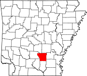
Mount Elba is an unincorporated community in Cleveland County, Arkansas, United States.[1] The land belonged to the Quapaw people, but it was opened to American settlement by a treaty in 1824. By the 1830s, a settlement was set up on the east bank of the Saline River on the road between Pine Bluff and Camden. Ferry service began in 1845 and a post office was opened in 1847. Mount Elba was a bustling community by the time of the American Civil War and a skirmish was fought there on March 30, 1864 as part of the Camden Expedition. The conflict badly damaged the town and the surrounding area. With the establishment of railroads, the importance of river traffic declined and the town's population dwindled. Only a few residences remain in the area.[2]
Geography
Mount Elba is located on County Road 122 a distance of 8.4 mi (13.5 km) south of Rison, or 10.3 mi (16.6 km) if taking Arkansas Highway 35 and County Road 114.[3]
Notes
- ^ U.S. Geological Survey Geographic Names Information System: Mount Elba, Arkansas
- ^ Polston 2017.
- ^ Google (July 8, 2020). "Rison to Mount Elba" (Map). Google Maps. Google. Retrieved July 8, 2020.
References
- Polston, Mike (2017). "Mount Elba (Cleveland County)". Encyclopedia of Arkansas. Retrieved July 8, 2020.
- v
- t
- e
Municipalities and communities of Cleveland County, Arkansas, United States
County seat: Rison
- Kingsland
- Rison
- New Edinburg
- Rye
- Staves
- Woodlawn
communities
- Bowman
- Harper
- Hudgin
- Hurricane
- Kingsland
- Lee
- Miller
- Niven
- Redland
- Rison
- Rowell
- Saline
- Smith
- White Oak
- Whiteville
- Arkansas portal
- United States portal
| |||||||||
|---|---|---|---|---|---|---|---|---|---|
| Combatants | |||||||||
| Campaigns |
| ||||||||
| Battles |
| ||||||||
| Aftermath |
| ||||||||
| |||||||||

33°51′03″N 92°09′31″W / 33.85083°N 92.15861°W / 33.85083; -92.15861
 | This article about a location in Cleveland County, Arkansas is a stub. You can help Wikipedia by expanding it. |
- v
- t
- e


