Maita Station (Kanagawa)
Metro station in Yokohama, Japan
B13 Maita Station 蒔田駅 | |||||||||||
|---|---|---|---|---|---|---|---|---|---|---|---|
 Entrance No.3 | |||||||||||
| General information | |||||||||||
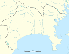
| Location | Miyamoto-chō 3-46, Minami, Yokohama, Kanagawa (横浜市南区宮元町三丁目46) Japan | ||||||||||
| Operated by | Yokohama City Transportation Bureau | ||||||||||
| Line(s) |  Blue Line Blue Line | ||||||||||
| Platforms | 2 side platforms | ||||||||||
| Tracks | 2 | ||||||||||
| Other information | |||||||||||
| Station code | B13 | ||||||||||
| History | |||||||||||
| Opened | 16 December 1972; 51 years ago (1972-12-16) | ||||||||||
| Passengers | |||||||||||
| 2008 | 11,315 daily | ||||||||||
| Services | |||||||||||
| |||||||||||
| |||||||||||


Maita Station (蒔田駅, Maita-eki) is an underground metro station located in Minami-ku, Yokohama, Kanagawa, Japan operated by the Yokohama Municipal Subway’s Blue Line (Line 1). It is 16.5 kilometers from the terminus of the Blue Line at Shōnandai Station.
Lines
- Yokohama Municipal Subway
- Blue Line
Station layout
Maita Station is an underground station with two opposed side platforms serving two tracks.
Platforms
| 1 | ■ Blue Line (Yokohama) | Kamiōoka, Totsuka, Shōnandai |
| 2 | ■ Blue Line (Yokohama) | Kannai, Yokohama, Shin-Yokohama, Azamino |
-
 Ticket gates
 -
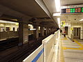 Platform


History
Maita Station was opened on 16 December 1972. Platform screen doors were installed in September of 2007.
References
- Harris, Ken and Clarke, Jackie. Jane's World Railways 2008-2009. Jane's Information Group (2008). ISBN 0-7106-2861-7
Wikimedia Commons has media related to Maita Station (Kanagawa).
External links
- Maita Station (Blue Line) (in Japanese)
- v
- t
- e
Stations of the Blue Line of the Yokohama Municipal Subway
- Azamino
- Nakagawa
- Center-Kita
- Center-Minami
- Nakamachidai
- Nippa
- Kita Shin-Yokohama
- Shin-Yokohama
- Kishine-kōen
- Katakurachō
- Mitsuzawa-kamichō
- Mitsuzawa-shimochō
- Yokohama
- Takashimachō
- Sakuragichō
- Kannai
- Isezaki-chōjamachi
- Bandōbashi
- Yoshinochō
- Maita
- Gumyōji
- Kamiōoka
- Kōnan-Chūō
- Kaminagaya
- Shimonagaya
- Maioka
- Totsuka
- Odoriba
- Nakada
- Tateba
- Shimoiida
- Shōnandai

35°25′48″N 139°36′36″E / 35.43000°N 139.61000°E / 35.43000; 139.61000
 | This Kanagawa Prefecture railroad station-related article is a stub. You can help Wikipedia by expanding it. |
- v
- t
- e


