Mafra, Santa Catarina
Municipality in South, Brazil

Flag

Seal
Pérola do Planalto
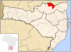
Location in the State of Santa Catarina

 Brazil
 Santa Catarina
 (2020 [1])
Mafra is a city located at the northern border of the state of Santa Catarina, Brazil. This city borders to the state of Paraná and its urban area is attached to the urban area of its interstate neighbour, Rio Negro. This city's population is composed primarily of descendants of European immigrants, especially from Germany (including Volga Germans) and Poland. This city is also known for its honey, which is said to have excellent quality.
References
- ^ IBGE 2020
26°07′S 49°48′W / 26.117°S 49.800°W / -26.117; -49.800
- v
- t
- e

- mesoregions of Santa Catarina
- Grande Florianópolis
- Norte Catarinense
- Oeste Catarinense
- Serrana
- Sul Catarinense
- Vale do Itajaí
 | This Santa Catarina, Brazil location article is a stub. You can help Wikipedia by expanding it. |
- v
- t
- e


