Kamerik
Town in Utrecht, Netherlands

Flag

Coat of arms
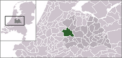

The village of Kamerik (dark green) and the statistical district "Kamerik and Kanis" (light green) in the municipality of Woerden.
(1 January 2010)
Kamerik is a village in the Dutch province of Utrecht. It is a part of the municipality of Woerden and is situated about 3 km north of Woerden.
In 2010 the village of Kamerik (including Kanis) had 3808 inhabitants. The built-up area of the town was 0.43 km² and contained 877 residences.[1] The statistical district "Kamerik and Kanis", which includes two villages and the surrounding countryside, has a population of around 3050.[2] This does not include the separate villages of Kamerik-Mijzijde and Oud-Kamerik.
Until it was merged with Woerden in 1989 Kamerik was a separate municipality. Between 1818 and 1857 it was split into two municipalities: Kamerik-Mijzijde on the west side, and Kamerik-Houtdijken on the east.[3]
References
- ^ Statistics Netherlands (CBS), Bevolkingskernen in Nederland 2001 [1]. Statistics are for the continuous built-up area.
- ^ Statistics Netherlands (CBS), Statline: Kerncijfers wijken en buurten 2003-2005 [2]. As of January 1, 2005.
- ^ Ad van der Meer and Onno Boonstra, "Repertorium van Nederlandse gemeenten", KNAW, 2006. "KNAW > Publicaties > Detailpagina". Archived from the original on 2007-02-20. Retrieved 2009-12-03.
Authority control databases | |
|---|---|
| International |
|
| National |
|
Wikimedia Commons has media related to Kamerik.
 | This Utrecht location article is a stub. You can help Wikipedia by expanding it. |
- v
- t
- e


