Kōʻula River
River in Hawaii, United States


• coordinates
• elevation
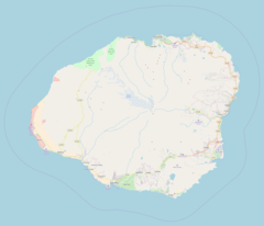
The Kō'ula River or Koula is the largest tributary of the Hanapēpē River on the Hawaiian island of Kauai. It rises at 4,642 ft (1415 meters) on the slopes of Mt. Waialeale and flows generally south for 9.2 miles to its confluence with the Manuahi Stream.[1][2] Beyond this point it is known as the Hanapēpē River.[3] The river has a long-term mean discharge of 85.2 cubic feet (0.99 cubic meters) per second.[4]
References
- ^ a b U.S. Geological Survey Geographic Names Information System: Kō'ula River
- ^ "Hanapepe River, Kauai Watershed features" (PDF). Retrieved September 11, 2022.
- ^ Koula River. "Koula River Topo Map, Kauai County HI (Hanapepe Area)". Topozone.com. Retrieved 2018-01-22.
- ^ "USGS 16047000 KOULA RIVER AT KOULA NR ELEELE,KAUAI,HI". Waterdata.usgs.gov. Retrieved 2018-01-22.


