Joppa, Alabama
Census-designated place in Alabama, United States
34°17′52″N 86°33′25″W / 34.29778°N 86.55694°W / 34.29778; -86.55694 (2020)[3]
Joppa is a census-designated place (CDP) and unincorporated community in Cullman and Marshall counties, Alabama, United States.[2] As of the 2020 census, its population was 556.[3]
History
Joppa was named after the ancient city of Jaffa.[4]
In the early 20th century, Joppa was an incorporated community within Cullman County and was listed on the U.S. Census from 1900 to 1920. It did not reappear on the census until 2010 when it was made a census-designated place (CDP).
On April 27, 2011, a tornado reportedly hit ground in the Joppa area as part of the 2011 Super Outbreak.
Geography
Joppa is located in northeastern Cullman County at 34°17′53″N 86°33′25″W / 34.298°N 86.557°W / 34.298; -86.557. A small portion of the CDP extends north into Marshall County. According to the U.S. Census Bureau, the Joppa CDP has a total area of 2.0 square miles (5.1 km2), of which 1.9 square miles (5.0 km2) are land and 0.039 square miles (0.1 km2), or 1.38%, are water.[1]
Joppa is located along Alabama State Route 69. The city of Arab is 3 miles (5 km) to the northeast, and the town of Baileyton is 4 miles (6 km) to the southwest.
Demographics
| Census | Pop. | Note | %± |
|---|---|---|---|
| 1900 | 130 | — | |
| 1910 | 167 | 28.5% | |
| 1920 | 166 | −0.6% | |
| 2010 | 501 | — | |
| 2020 | 556 | 11.0% | |
| U.S. Decennial Census[5] | |||
Notable people
- Jack Lively, former Major League Baseball pitcher for the Detroit Tigers
References
- ^ a b "2021 U.S. Gazetteer Files". United States Census Bureau. Retrieved April 18, 2022.
- ^ a b c U.S. Geological Survey Geographic Names Information System: Joppa, Alabama
- ^ a b "Joppa CDP, Alabama: 2020 DEC Redistricting Data (PL 94-171)". U.S. Census Bureau. Retrieved April 18, 2022.
- ^ Gannett, Henry (1905). The Origin of Certain Place Names in the United States. Govt. Print. Off. pp. 171.
- ^ "U.S. Decennial Census". Census.gov. Retrieved June 6, 2013.
- v
- t
- e
Municipalities and communities of Cullman County, Alabama, United States
County seat: Cullman

- East Point
- Joppa‡
communities
‡This populated place also has portions in an adjacent county or counties
- Alabama portal
- United States portal
Municipalities and communities of Marshall County, Alabama, United States | ||
|---|---|---|
County seat: Guntersville | ||
| Cities | 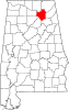 | |
| Towns | ||
| CDPs |
| |
| Unincorporated communities | ||
| Ghost town | ||
| Footnotes | ‡This populated place also has portions in an adjacent county or counties | |
| ||
 | This Cullman County, Alabama state location article is a stub. You can help Wikipedia by expanding it. |
- v
- t
- e


