Haule
Village in Friesland, Netherlands
Haule De Haule | |
|---|---|
Village | |
 Protestant Church | |
 Location in Ooststellingwerf municipality | |
53°2′13″N 6°18′15″E / 53.03694°N 6.30417°E / 53.03694; 6.30417 | |
| Country |  Netherlands Netherlands |
| Province |  Friesland Friesland |
| Municipality |  Ooststellingwerf Ooststellingwerf |
| Area | |
| • Total | 14.70 km2 (5.68 sq mi) |
| Elevation | 6 m (20 ft) |
| Population (2021)[1] | |
| • Total | 590 |
| • Density | 40/km2 (100/sq mi) |
| Postal code | 8432[1] |
| Dialing code | 0516 |
Haule (West Frisian: De Haule) is a village consisting of about 600 inhabitants in the municipality of Ooststellingwerf[3] in the east of Friesland in the Netherlands.
The village was first mentioned in 1408 as Die Hauwele. The etymology is unclear.[4] Haule started as a stretched agricultural community on a sandy ridge surrounded by moorland. Up to the 16th century, wolves used to roam the wilderness. The church was built in 1328. Haule was home to 142 people in 1840.[5]
Gallery
-
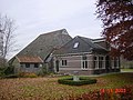 Farm in Haule
 -
 The Blauwe Bos (Blue Forest)


References
- ^ a b c "Kerncijfers wijken en buurten 2021". Central Bureau of Statistics. Retrieved 1 April 2022.
- ^ "Postcodetool for 8432PA". Actueel Hoogtebestand Nederland (in Dutch). Het Waterschapshuis. Retrieved 1 April 2022.
- ^ Villages Archived 2017-09-28 at the Wayback Machine - Ooststellingwerf Municipality (in Dutch)
- ^ "Haule - (geografische naam)". Etymologiebank (in Dutch). Retrieved 1 April 2022.
- ^ "Haule". Plaatsengids (in Dutch). Retrieved 1 April 2022.
External links
 Media related to Haule, Ooststellingwerf at Wikimedia Commons
- Korfball club VZK De Haule
- v
- t
- e
Populated places in the municipality of Ooststellingwerf
- Oosterwolde
- Appelscha
- Donkerbroek
- Elsloo
- Fochteloo
- Haule
- Haulerwijk
- Langedijke
- Makkinga
- Nijeberkoop
- Oldeberkoop
- Ravenswoud
- Waskemeer
- Aekinga
- Oude Willem (partially)
 | This Friesland location article is a stub. You can help Wikipedia by expanding it. |
- v
- t
- e


