Grade II* listed buildings in Bournemouth
Map all coordinates using OpenStreetMap
Download coordinates as:
- KML
- GPX (all coordinates)
- GPX (primary coordinates)
- GPX (secondary coordinates)
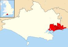
There are over 20,000 Grade II* listed buildings in England. This page is a list of these buildings in the district of Bournemouth in Dorset.
List of buildings
| Name | Location | Type | Completed [note 1] | Date designated | Grid ref.[note 2] Geo-coordinates | Entry number [note 3] | Image |
|---|---|---|---|---|---|---|---|
| Bournemouth War Memorial with associated steps, enclosure and balustrade | Bournemouth | War memorial | 1922 | 12 March 2014 | SZ0843191322 50°43′17″N 1°52′55″W / 50.721456°N 1.881904°W / 50.721456; -1.881904 (Bournemouth War Memorial with associated steps, enclosure and balustrade) | 1418017 |  More images |
| Church of St Alban | Bournemouth | Church | 1907–09 | 27 February 1976 | SZ0966793231 50°44′19″N 1°51′52″W / 50.738611°N 1.864371°W / 50.738611; -1.864371 (Church of St Alban) | 1152784 |  More images |
| Church of St Ambrose | Bournemouth | Church | 1898–1900 | 27 February 1976 | SZ0714090871 50°43′03″N 1°54′01″W / 50.717425°N 1.900227°W / 50.717425; -1.900227 (Church of St Ambrose) | 1108803 |  More images |
| Church of St Andrew | Kinson | Church | 13th century | 5 May 1972 | SZ0679596925 50°46′19″N 1°54′18″W / 50.77187°N 1.905004°W / 50.77187; -1.905004 (Church of St Andrew) | 1324727 |  More images |
| Church of St John the Evangelist | Boscombe | Church | 1893–95 | 27 February 1976 | SZ1105591713 50°43′30″N 1°50′41″W / 50.724936°N 1.844746°W / 50.724936; -1.844746 (Church of St John the Evangelist) | 1152799 |  More images |
| Church of St Michael (including tower) | Bournemouth | Church | 1873–76 | 5 May 1952 | SZ0794391197 50°43′13″N 1°53′20″W / 50.720346°N 1.888846°W / 50.720346; -1.888846 (Church of St Michael (including tower)) | 1324732 |  More images |
| House of Bethany | Bournemouth | House | 1880 | 27 February 1976 | SZ1085692112 50°43′43″N 1°50′51″W / 50.728528°N 1.847554°W / 50.728528; -1.847554 (House of Bethany) | 1108819 |  More images |
| Roman Catholic Church of the Annunciation | Bournemouth | Church | 1905–06 | 27 February 1976 | SZ0972493181 50°44′17″N 1°51′49″W / 50.738161°N 1.863565°W / 50.738161; -1.863565 (Roman Catholic Church of the Annunciation) | 1110033 |  More images |
| Russell-Cotes Art Gallery & Museum | Bournemouth | House | 1894 | 1 August 1974 | SZ0922290894 50°43′03″N 1°52′15″W / 50.717603°N 1.870735°W / 50.717603; -1.870735 (Russell-Cotes Art Gallery & Museum) | 1108857 |  More images |
See also
Notes
- ^ The date given is the date used by Historic England as significant for the initial building or that of an important part in the structure's description.
- ^ Sometimes known as OSGB36, the grid reference is based on the British national grid reference system used by the Ordnance Survey.
- ^ The "List Entry Number" is a unique number assigned to each listed building and scheduled monument by Historic England.
External links
- v
- t
- e
- Bedfordshire
- Berkshire
- Bristol
- Buckinghamshire
- Cambridgeshire
- Cheshire
- Cornwall
- Cumbria
- Derbyshire
- Devon
- Dorset
- Durham
- East Sussex
- East Riding of Yorkshire
- Essex
- Gloucestershire
- Greater London
- Greater Manchester
- Hampshire
- Herefordshire
- Hertfordshire
- Isle of Wight
- Kent
- Lancashire
- Leicestershire
- Lincolnshire
- Merseyside
- Norfolk
- North Yorkshire
- Northamptonshire
- Northumberland
- Nottinghamshire
- Oxfordshire
- Rutland
- Shropshire
- Somerset
- South Yorkshire
- Staffordshire
- Suffolk
- Surrey
- Tyne and Wear
- Warwickshire
- West Midlands
- West Sussex
- West Yorkshire
- Wiltshire
- Worcestershire
- Allerdale
- Amber Valley
- Ashford
- Babergh
- Barrow-in-Furness
- Basildon
- Basingstoke and Deane
- Bath and North East Somerset
- Bolsover
- Boston
- Bournemouth
- Bradford
- Braintree
- Breckland
- Brentwood
- Brighton and Hove
- Bristol
- Broadland
- Calderdale
- Cambridge
- Camden
- Canterbury
- Carlisle
- Castle Point
- Chelmsford
- Cheltenham
- Cherwell
- Cheshire East
- Cheshire West and Chester
- Chesterfield
- Chiltern
- Christchurch
- Colchester
- Copeland
- Corby
- Cotswold
- Craven
- Dartford
- Daventry
- Dover
- East Cambridgeshire
- Exeter
- Mendip
- North Somerset
- Poole
- Sedgemoor
- South Somerset
- Stoke-on-Trent
- Taunton Deane
- West Somerset
- York


