Gergovie Monument
Stone monument in Puy-de-Dôme, France
You can help expand this article with text translated from the corresponding article in French. (October 2019) Click [show] for important translation instructions.
- View a machine-translated version of the French article.
- Machine translation, like DeepL or Google Translate, is a useful starting point for translations, but translators must revise errors as necessary and confirm that the translation is accurate, rather than simply copy-pasting machine-translated text into the English Wikipedia.
- Do not translate text that appears unreliable or low-quality. If possible, verify the text with references provided in the foreign-language article.
- You must provide copyright attribution in the edit summary accompanying your translation by providing an interlanguage link to the source of your translation. A model attribution edit summary is
Content in this edit is translated from the existing French Wikipedia article at [[:fr:Monument de Gergovie]]; see its history for attribution. - You may also add the template
{{Translated|fr|Monument de Gergovie}}to the talk page. - For more guidance, see Wikipedia:Translation.
 | |
 | |
| Type | Monument in Volvic stone |
|---|---|
| Completion date | 1900 (1900) |
The Gergovie Monument (French: monument de Gergovie) or Memorial to Vercingetorix (French: monument commémoratif à Vercingétorix) is a monument by the Clermontois architect Jean Teillard [fr] built in 1900[1] on the eastern edge of the Gergovie plateau, a few kilometers south of Clermont-Ferrand in the French departement of Puy-de-Dôme in Auvergne. It commemorates Vercingetorix's victory over Julius Caesar on this site in 52 BC.[1][2]
The monument was registered as a French Monument historique in March 2018[3] (the oppidum was registered in 2013) and in November of the same year, the monument was classified, included in a much larger classification of a major part of the Gergovie plateau.[4]
Characteristics

The 26-meter-high monument[1] is made of Volvic stone [fr]. It is composed of a support base with 3 columns topped by Corinthian capitals and a Gaulish helmet in whimsical form.[1] The base houses a crypt with a cenotaph of Vercingetorix.[2] Three plates adorn the building.
One of the plates, above the entrance of the crypt on the west side, has the following inscription in Latin:
GERGOVIA
IN HIS LOCIS DVX ARVERNORVM
VERCINGETORIX
C CESAREM INVADENTEM PROFLIGAVIT
Translated into English:
Gergovie / In this place, the Arverni chief / Vercingetorix / defeated the invader Gaius Caesar
Photo gallery
-
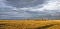 The Gergovie plateau seen from south with the monument in the background
 -
 Other side of the building with a plate with the name of officials who contributed to its construction.
 -
 The winged helmet "Gaulish".
 -
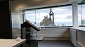 The monument seen from one of the rooms of the Museum of the battle of Gergovia (MAB).


See also
- Monument à Vercingétorix of Millet.
References
- Partial translation of the French Wikipedia article (22 October 2019 version).
- ^ a b c d The Monument Archived 2020-06-27 at the Wayback Machine, Tourist office of Gergovie (in French)
- ^ a b Ehrard, Antoinette (1980). Vercingétorix contre Gergovie ? Nos ancêtres les Gaulois (in French). Clermont-Ferrand: Faculté des lettres et sciences humaines de Clermont-Ferrand.
- ^ "Oppidum de Gergovie", French Ministry of Culture. (in French)
- ^ "List of the Historical monuments protected buildings in 2018", published in Journal Officiel de la République Française, 12 may 2019, text 18. (in French)
External links
- Old photos of the monument and the Gergovie plateau Archived 2019-10-23 at the Wayback Machine on pierreseche.com
| Authority control databases: Geographic |
|
|---|
45°43′16″N 3°07′37″E / 45.7210°N 3.1269°E / 45.7210; 3.1269


