Dera Ghazi Khan Division
Division in Punjab, Pakistan
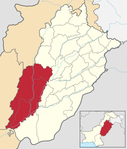
Dera Ghazi Khan Division ڈیرہ غازی خان ڈویژن | |
|---|---|
Division | |
 | |
| Country |  Pakistan Pakistan |
| Province |  Punjab Punjab |
| Capital | Dera Ghazi Khan |
| Area | |
| • Total | 38,778 km2 (14,972 sq mi) |
| Population (2017)[1] | |
| • Total | 11,014,398 |
| • Density | 280/km2 (740/sq mi) |
Dera Ghazi Khan Division is an administrative division of the Punjab Province, Pakistan. The division was established in 1982, reforms of 2000 abolished the third tier of government but division system was restored again in 2008. Hindko and Pashto are the two dominant languages of this division [2][3][4]
Districts
It contains the following districts:[5]
- Dera Ghazi Khan District
- Jampur District
- Kot Addu District
- Layyah District
- Muzaffargarh District
- Rajanpur District
- Taunsa District
History
During British rule, All the districts that later formed Dera Ghazi Khan Division, collectively formed a district of Multan Division. [6] Dera Ghazi Khan was made into a separate division in 1982 and took more than 60% land area of Multan division. The division system was abolished in 2000 but restored in 2008 after the restoration of democracy in the country.[7]
Demographics
According to 2017 census, DG Khan Division had a population of 11,021,214, which includes 5,627,413 males and 5,392,956 females. DG Khan Division constitutes 10,994,261 Muslims, 17,738 Christians, 5,778 Ahmadi followed by 2,298 Hindus, 678 scheduled castes and 461 others.
Religions in DG Khan Division (2017)
Islam (99.75%)
Christianity (0.16%)
Ahmadi (0.05%)
Hinduism (0.02%)
Scheduled Caste (0.001%)
Other (0.001%)
See also
- Dera Ghazi Khan
- Louis Dane - In 1876 he was posted to the Punjab as assistant commissioner in Dera Ghazi Khan
- Mustafa Zaidi - served as assistant commissioner of Dera Ghazi Khan
- Andrew Jukes (missionary) He was sent to Baloch mission at Dera Ghazi Khan, where he stayed until 1906
- Robert Groves Sandeman - in 1866 he was appointed district officer of Dera Ghazi Khan
References
- ^ "DISTRICT WISE CENSUS RESULTS CENSUS 2017" (PDF). www.pbscensus.gov.pk. Archived from the original (PDF) on 2017-08-29.
- ^ http://health.punjab.gov.pk/?q=system/files/Division_and_district_wise_facilities.pdf Archived 2015-04-16 at the Wayback Machine
- ^ "Punjab Government Plans to Carve a New District from Lahore". Archived from the original on 2010-06-03.
- ^ Akhtar*, Sohail (2018-05-11). "The Historical and Archeological Significance Dera Ghazi Khan District through Ages". Archaeology & Anthropology: Open Access. 2 (1): 1–4.
- ^ Divisions/Districts of Pakistan Archived 2006-09-30 at the Wayback Machine
Note: Although divisions as an administrative structure has been abolished, the election commission of Pakistan still groups districts under the division names - ^ Dera Ghāzi Khān District Imperial Gazetteer of India, v. 11, p. 248.
- ^ "KHĀN". Gazetteer of the Persian Gulf, Oman and Central Arabia Online. Retrieved 2024-05-18.
- v
- t
- e
- Bahawalpur
- Dera Ghazi Khan
- Faisalabad
- Gujranwala
- Gujrat
- Lahore
- Mianwali
- Multan
- Rawalpindi
- Sahiwal
- Sargodha
None
30°28′N 70°24′E / 30.467°N 70.400°E / 30.467; 70.400
 | This article about a location in Dera Ghazi Khan District, Punjab (Pakistan) is a stub. You can help Wikipedia by expanding it. |
- v
- t
- e


