Caseara
Municipality in North, Brazil
9°16′40″S 49°57′21″W / 9.27778°S 49.95583°W / -9.27778; -49.95583 (2020 [1])
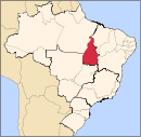
Caseara is a municipality located in the Brazilian state of Tocantins. Its population was 5,442 (2020) and its area is 1,692 km².[2]
The municipality contains 10.66% of the 1,678,000 hectares (4,150,000 acres) Ilha do Bananal / Cantão Environmental Protection Area, created in 1997.[3] The headquarters and visitor center of Cantão State Park are located just outside the town of Caseara. The municipality plans to open a hiking/bicycle trail from the town center to the park's visitor center in 2014.
References
- v
- t
- e

Capital: Palmas
Ocidental
Oriental
 | This Tocantins, Brazil location article is a stub. You can help Wikipedia by expanding it. |
- v
- t
- e


