Bussière-Dunoise
Commune in Nouvelle-Aquitaine, France
Commune in Nouvelle-Aquitaine, France
Location of Bussière-Dunoise

(2020–2026) Christophe Lavaud[1]
1
(2021)[2]
23036 /23320
(avg. 415 m or 1,362 ft)
Bussière-Dunoise (French pronunciation: [bysjɛʁ dynwaz]; Occitan: Bussiera de Dun) is a commune in the Creuse department in the Nouvelle-Aquitaine region in central France.
Geography
An area of forestry and farming comprising the village and several hamlets situated some 8 miles (13 km) northwest of Guéret, at the junction of the D14, D47 and the D22. Four small tributaries of the Creuse have their source within the commune.
Population
| Year | Pop. | ±% |
|---|---|---|
| 1962 | 1,306 | — |
| 1968 | 1,470 | +12.6% |
| 1975 | 1,329 | −9.6% |
| 1982 | 1,247 | −6.2% |
| 1990 | 1,139 | −8.7% |
| 1999 | 1,098 | −3.6% |
| 2008 | 1,105 | +0.6% |
Sights
- The church of St. Symphorien, dating from the twelfth century.
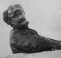
- A memorial in stone, to French aviator, Jules Védrines, whose wife was born here.
See also
References
- ^ "Répertoire national des élus: les maires" (in French). data.gouv.fr, Plateforme ouverte des données publiques françaises. 13 September 2022.
- ^ "Populations légales 2021". The National Institute of Statistics and Economic Studies. 28 December 2023.
Wikimedia Commons has media related to Bussière-Dunoise.
- v
- t
- e
Communes of the Creuse department 

- Ahun
- Ajain
- Alleyrat
- Anzême
- Arfeuille-Châtain
- Arrènes
- Ars
- Aubussonsubpr
- Auge
- Augères
- Aulon
- Auriat
- Auzances
- Azat-Châtenet
- Azerables
- Banize
- Basville
- Bazelat
- Beissat
- Bellegarde-en-Marche
- Bénévent-l'Abbaye
- Bétête
- Blaudeix
- Blessac
- Bonnat
- Bord-Saint-Georges
- Bosmoreau-les-Mines
- Bosroger
- Bourganeuf
- Le Bourg-d'Hem
- Boussac
- Boussac-Bourg
- La Brionne
- Brousse
- Budelière
- Bussière-Dunoise
- Bussière-Nouvelle
- Bussière-Saint-Georges
- La Celle-Dunoise
- La Celle-sous-Gouzon
- La Cellette
- Ceyroux
- Chamberaud
- Chambonchard
- Chambon-Sainte-Croix
- Chambon-sur-Voueize
- Chamborand
- Champagnat
- Champsanglard
- La Chapelle-Baloue
- La Chapelle-Saint-Martial
- La Chapelle-Taillefert
- Chard
- Charron
- Châtelard
- Châtelus-le-Marcheix
- Châtelus-Malvaleix
- Le Chauchet
- La Chaussade
- Chavanat
- Chénérailles
- Chéniers
- Clairavaux
- Clugnat
- Colondannes
- Le Compas
- La Courtine
- Cressat
- Crocq
- Crozant
- Croze
- Domeyrot
- Dontreix
- Le Donzeil
- Dun-le-Palestel
- Évaux-les-Bains
- Faux-la-Montagne
- Faux-Mazuras
- Felletin
- Féniers
- Flayat
- Fleurat
- Fontanières
- La Forêt-du-Temple
- Fransèches
- Fresselines
- Fursac
- Gartempe
- Genouillac
- Gentioux-Pigerolles
- Gioux
- Glénic
- Gouzon
- Le Grand-Bourg
- Guéretpref
- Issoudun-Létrieix
- Jalesches
- Janaillat
- Jarnages
- Jouillat
- Ladapeyre
- Lafat
- Lavaufranche
- Lavaveix-les-Mines
- Lépaud
- Lépinas
- Leyrat
- Linard-Malval
- Lioux-les-Monges
- Lizières
- Lourdoueix-Saint-Pierre
- Lupersat
- Lussat
- Magnat-l'Étrange
- Mainsat
- Maison-Feyne
- Maisonnisses
- Malleret
- Malleret-Boussac
- Mansat-la-Courrière
- Les Mars
- Marsac
- Le Mas-d'Artige
- Mautes
- Mazeirat
- La Mazière-aux-Bons-Hommes
- Méasnes
- Mérinchal
- Montaigut-le-Blanc
- Montboucher
- Le Monteil-au-Vicomte
- Mortroux
- Mourioux-Vieilleville
- Moutier-d'Ahun
- Moutier-Malcard
- Moutier-Rozeille
- Naillat
- Néoux
- Noth
- La Nouaille
- Nouhant
- Nouzerines
- Nouzerolles
- Nouziers
- Parsac-Rimondeix
- Peyrabout
- Peyrat-la-Nonière
- Pierrefitte
- Pionnat
- Pontarion
- Pontcharraud
- La Pouge
- Poussanges
- Puy-Malsignat
- Reterre
- Roches
- Rougnat
- Royère-de-Vassivière
- Sagnat
- Saint-Agnant-de-Versillat
- Saint-Agnant-près-Crocq
- Saint-Alpinien
- Saint-Amand
- Saint-Amand-Jartoudeix
- Saint-Avit-de-Tardes
- Saint-Avit-le-Pauvre
- Saint-Bard
- Saint-Chabrais
- Saint-Christophe
- Saint-Dizier-la-Tour
- Saint-Dizier-les-Domaines
- Saint-Dizier-Masbaraud
- Saint-Domet
- Sainte-Feyre
- Sainte-Feyre-la-Montagne
- Saint-Éloi
- Saint-Fiel
- Saint-Frion
- Saint-Georges-la-Pouge
- Saint-Georges-Nigremont
- Saint-Germain-Beaupré
- Saint-Goussaud
- Saint-Hilaire-la-Plaine
- Saint-Hilaire-le-Château
- Saint-Julien-la-Genête
- Saint-Julien-le-Châtel
- Saint-Junien-la-Bregère
- Saint-Laurent
- Saint-Léger-Bridereix
- Saint-Léger-le-Guérétois
- Saint-Loup
- Saint-Maixant
- Saint-Marc-à-Frongier
- Saint-Marc-à-Loubaud
- Saint-Marien
- Saint-Martial-le-Mont
- Saint-Martial-le-Vieux
- Saint-Martin-Château
- Saint-Martin-Sainte-Catherine
- Saint-Maurice-la-Souterraine
- Saint-Maurice-près-Crocq
- Saint-Médard-la-Rochette
- Saint-Merd-la-Breuille
- Saint-Michel-de-Veisse
- Saint-Moreil
- Saint-Oradoux-de-Chirouze
- Saint-Oradoux-près-Crocq
- Saint-Pardoux-d'Arnet
- Saint-Pardoux-le-Neuf
- Saint-Pardoux-les-Cards
- Saint-Pardoux-Morterolles
- Saint-Pierre-Bellevue
- Saint-Pierre-Chérignat
- Saint-Pierre-le-Bost
- Saint-Priest
- Saint-Priest-la-Feuille
- Saint-Priest-la-Plaine
- Saint-Priest-Palus
- Saint-Quentin-la-Chabanne
- Saint-Sébastien
- Saint-Silvain-Bas-le-Roc
- Saint-Silvain-Bellegarde
- Saint-Silvain-Montaigut
- Saint-Silvain-sous-Toulx
- Saint-Sulpice-le-Dunois
- Saint-Sulpice-le-Guérétois
- Saint-Sulpice-les-Champs
- Saint-Vaury
- Saint-Victor-en-Marche
- Saint-Yrieix-la-Montagne
- Saint-Yrieix-les-Bois
- Sannat
- Sardent
- La Saunière
- Savennes
- Sermur
- La Serre-Bussière-Vieille
- Soubrebost
- Soumans
- Sous-Parsat
- La Souterraine
- Tardes
- Tercillat
- Thauron
- Toulx-Sainte-Croix
- Trois-Fonds
- Vallière
- Vareilles
- Verneiges
- Vidaillat
- Viersat
- Vigeville
- Villard
- La Villedieu
- La Villeneuve
- La Villetelle
- pref: prefecture
- subpr: subprefecture
| Authority control databases: National |
|
|---|
 | This Creuse geographical article is a stub. You can help Wikipedia by expanding it. |
- v
- t
- e


