Ballynagaul, County Waterford
Gaeltacht district in Munster, Ireland
Ballynagaul Baile na nGall | |
|---|---|
Gaeltacht district | |
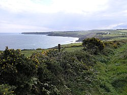 Coastal path in Ballynagaul More (Baile na nGall Mór) townland | |
| 52°02′53″N 7°34′01″W / 52.048°N 7.567°W / 52.048; -7.567 | |
| Country | Ireland |
| Province | Munster |
| County | Waterford |
| Time zone | UTC+0 (WET) |
| • Summer (DST) | UTC-1 (IST (WEST)) |
| Irish Grid Reference | X297885 |
Ballynagaul (Irish: Baile na nGall, its official name) is a Gaeltacht area within the Irish-speaking Gaeltacht na nDéise part of County Waterford. Comprising the townlands of Baile na nGall Mór and Baile na nGall Beag (Ballynagaul More and Ballynagaul Beg),[1][2] it is located approximately 9.6 kilometres southeast of Dungarvan. The village of Ring is located in the area.[3]
Ballynagaul contains a pub (Tig an Ceoil),[4] a shop, a playground known as 'An Imearlann',[5] a small restaurant, a fishing pier (Cé Bhaile na nGall), and a beach.[4] "Criostal na Rinne", a workshop where hand-cut glassware is made is also located in Baile na nGall.[6]
See also
References
- ^ "Baile na nGall Beag / Ballynagaul Beg". logainm.ie. Placenames Database of Ireland. Retrieved 18 June 2022.
- ^ "Baile na nGall Mór / Ballynagaul More". logainm.ie. Placenames Database of Ireland. Retrieved 18 June 2022.
- ^ "An Rinn / Ringville". logainm.ie. Placenames Database of Ireland. Retrieved 18 June 2022.
- ^ a b "Port Lairge-Waterford" (PDF). Comhlacht Forbartha na nDeise. Archived (PDF) from the original on 4 March 2016. Retrieved 10 January 2021 – via deiseabu.files.wordpress.com.
- ^ "Faoiseamh & Spraoi / Leisure - Comhlucht Forbartha na nDéise". Deise.ie. Archived from the original on 29 November 2014. Retrieved 2 July 2015.
- ^ "Criostal na Rinne". Criostal.com. Archived from the original on 28 February 2021. Retrieved 2 July 2015.
Criostal na Rinne, Ballynagaul Beg, Dungarvan, Co. Waterford
- v
- t
- e
Places in County Waterford

Townlands
- Abbeyside
- Affane
- Aglish
- Annestown
- Ardmore
- Ballinacourty
- Ballynagaul
- Ballinameela
- Ballinamult
- Ballinroad
- Ballybeg
- Ballygunner
- Ballylaneen
- Ballymacarbry
- Ballysaggart
- Boatstrand
- Bunmahon
- Cheekpoint
- Clashmore
- Dunhill
- Dunmore East
- Fenor
- Ferrybank
- Grange
- Kill
- Kilmeadan
- Kilrossanty
- Knockanore
- Lemybrien
- Mahon Bridge
- Mothel
- Old Parish
- Passage East
- Rathgormack
- Ring
- Sliabh gCua
- Stradbally
- Tooraneena
- Villierstown
- Woodstown
- List of townlands of County Waterford
- Category:Mountains and hills of County Waterford
- Category:Rivers of County Waterford
- Category:Geography of County Waterford
 | This article related to the geography of County Waterford, Ireland is a stub. You can help Wikipedia by expanding it. |
- v
- t
- e


