Analaliry
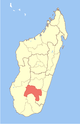
Place in Ihorombe, Madagascar
22°47′S 46°15′E / 22.783°S 46.250°E / -22.783; 46.250 Madagascar
 (2001)[2]
313
Analaliry is a rural municipality in Madagascar. It belongs to the district of Ihosy, which is a part of Ihorombe Region. The population of the commune was estimated to be approximately 5,000 in 2001 commune census.[2]
Only primary schooling is available. Farming and raising livestock provides employment for 10% and 90% of the working population. The most important crop is rice, while other important products are peanuts, beans, cassava and sweet potatoes.[2]
Geography
Analaliry is situated at 40 km from Ihosy.[3]
References
- ^ Estimated based on DEM data from Shuttle Radar Topography Mission
- ^ a b c "ILO census data". Cornell University. 2002. Retrieved 2008-04-24.
- ^ CADRE DU PROGRAMME ACORDS, MOYEN POUR LA MISE EN PLACE DE LA DECENTRALISATIONCAS DES CINQ COMMUNES RURALES : Analaliry, Analavoka, Iakora,
22°47′S 46°15′E / 22.783°S 46.250°E / -22.783; 46.250
 | This Ihorombe location article is a stub. You can help Wikipedia by expanding it. |
- v
- t
- e


